Catalog Archive
Auction 137, Lot 482

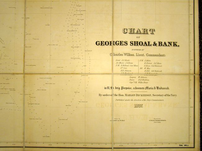
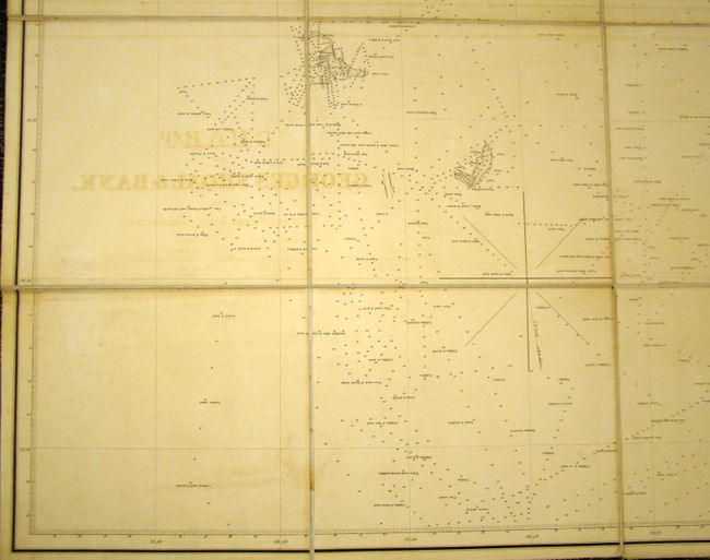
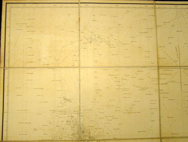
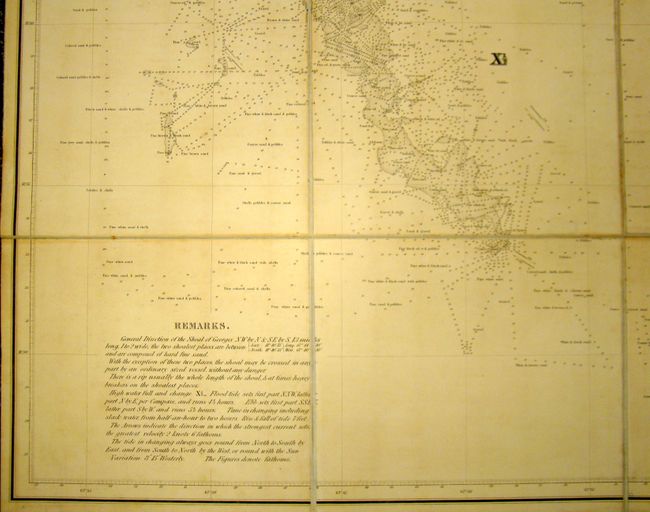
Rare Chart of George's Bank

"Chart of Georges Shoal & Bank, Surveyed by Charles Wilkes, Lieut. Commandant…", Wilkes, Charles

Subject: North Atlantic

Period: 1837 (dated)

Publication:

Color: Black & White

Size:
44 x 39 inches
111.8 x 99.1 cm
Download High Resolution Image
(or just click on image to launch the Zoom viewer)

This is one of only two charts produced by Charles Wilkes prior to leading the United States Exploring Expedition from 1838-1842.

Rumors of Europeans finding fertile fishing grounds in the northwestern Atlantic circulated for 500 years prior to John Cabot’s discovery of Newfoundland in 1497. In the early 16th century, Giovanni da Verrazano specifically discovered Georges Bank, naming it Armelline Shoals. In 1605 English colonists renamed it St. George, and developed it into a very important fishing ground. As such, there were many charts devoted to the area, but none with as much detail as Wilkes' chart. There are over 1,000 soundings with very detailed descriptions of the ocean floor. There are also remarks at lower-left that point out shallow areas and tidal information. Wilkes’ survey was so complete, that it was 100 years before another government survey was ordered. Dissected into 16 sections and backed with linen, as issued. A very rare example.

References:

Condition: B+

There is some moderate offsetting of the title with light uniform toning, else very good.

Estimate: $650 - $800

Unsold

Closed on 9/14/2011

Archived