Catalog Archive
Auction 137, Lot 475

"A View of the General & Coasting Trade-Winds in the Atlantick & Indian Oceans", Moll, Herman

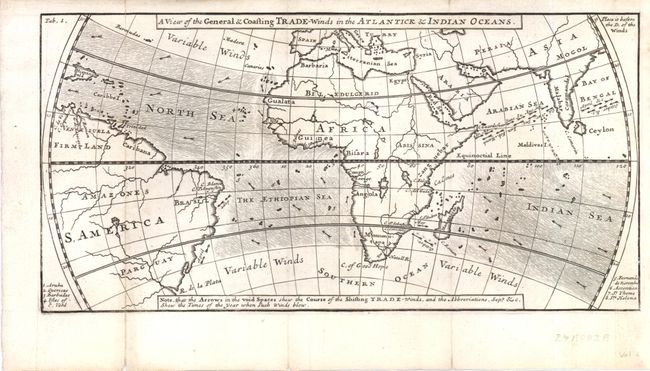
Subject: Atlantic Ocean

Period: 1699 (circa)

Publication: Dampier's A New Voyage Round the World

Color: Black & White

Size:
11.8 x 5.8 inches
30 x 14.7 cm
Download High Resolution Image
(or just click on image to launch the Zoom viewer)

Although his name does not appear on the map, it was engraved by Herman Moll. The map is identical in style and size to the map of the winds in the South Ocean that does bear Moll's name. The map depicts the winds from 30 degrees north latitude to 30 degrees south latitude in the North Sea, The Ethiopian Sea and Indian Ocean. At the right are portions of Asia; in the center is Africa; and on the left is the east part of South America. A note at the bottom states, "Note, that the Arrows in the void Spaces shew the Course of the Shifting Trade-Winds, and the Abbreviations, Sept &c. Shew the Times of the year when such Winds blow".

The map appeared in William Dampier's description of his first circumnavigation between 1679 and 1691, during which he was among the first group of Englishmen to land in New Holland (Australia). His memoir, A Voyage Round the World, was published in 1697, and went through three more editions in the next two years.

References:

Condition: B+

Backed with Japanese tissue to repair very minor loss primarily in the blank margins. Issued folded and now flat.

Estimate: $400 - $475

Sold for: $200

Closed on 9/14/2011

Archived