Catalog Archive
Auction 137, Lot 449

"America Meridionalis Concinnata juxta Observationes … per G. de L'Isle, Geographum…", Wolff, Jeremias

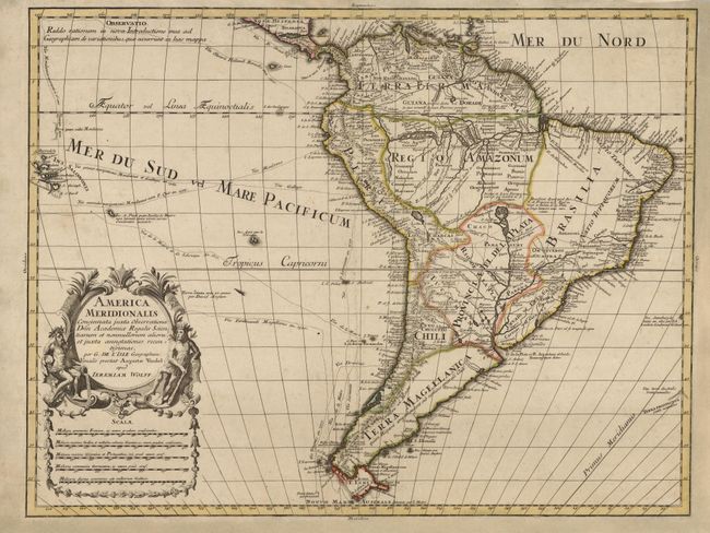
Subject: South America

Period: 1715 (circa)

Publication:

Color: Hand Color

Size:
23.3 x 18 inches
59.2 x 45.7 cm
Download High Resolution Image
(or just click on image to launch the Zoom viewer)

Wolff's map of all South America is based on Guillaume Delisle's map of 1705. While faithfully following most of its cartography, it depicts the southern portion of the continent inclined too far to the west. There is good detail and interesting notations concerning recent explorations of the interior. The tracks of several voyages (Magellan, Schouten, Medana, Sarmiento, le Maire, Gallego, Olivier and Drake) are shown in the Pacific where the Solomon Islands are also delineated. The composition is graced by the same elegant title cartouche as Delisle's map, which is flanked by a river god at left pouring water from a barrel to represent the waters of the Amazon River and a native warrior at right.

References:

Condition: B+

Old color with a few separations along centerfold expertly repaired and two minute wormholes in blank areas of map image only visible when held up to strong light. Additional expert paper restoration in blank margins.

Estimate: $250 - $350

Sold for: $180

Closed on 9/14/2011

Archived