Catalog Archive
Auction 137, Lot 441

"The Island of Jamaica and Cape Gracias a Dios with the Banks", Jefferys, Thomas
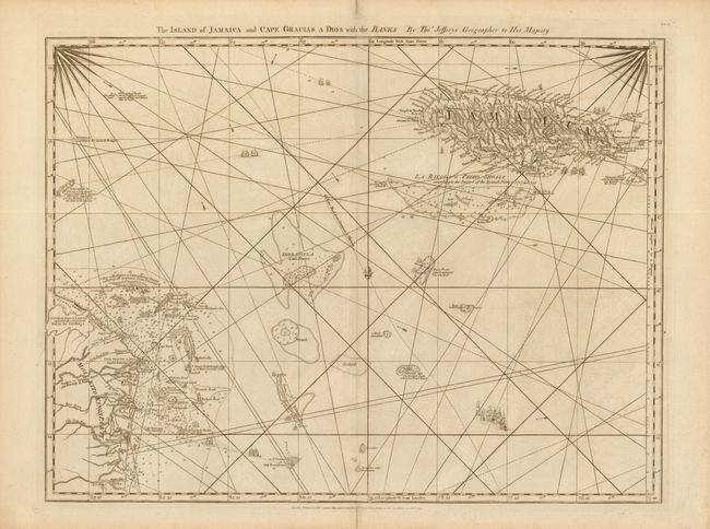
Subject: Jamaica

Period: 1775 (dated)

Publication: The West Indian Atlas

Color: Black & White

Size:
24.7 x 19 inches
62.7 x 48.3 cm
Download High Resolution Image
(or just click on image to launch the Zoom viewer)

A superb chart of Jamaica and the Mosquito coasts of Honduras and Nicaragua, labeled here Moskito King's Party. The map includes extraordinary navigational details with extensive depth soundings, shoals and reefs, and includes the Galleons Track from Cartagena to Havana. Various types of vegetation are identified including coconut trees, pine trees, bamboo, and grape vines. The chart is embellished with two dramatic wind roses in the upper corners and several shipping routes. This is the first state, published by Robert Sayer.

References: Sellers & Van Ee #1929.

Condition: B+

On heavy, watermarked paper with faint offsetting and centerfold separations at top and bottom that do not enter map image, closed on verso with archival materials.

Estimate: $400 - $475

Sold for: $210

Closed on 9/14/2011

Archived