Catalog Archive
Auction 137, Lot 430

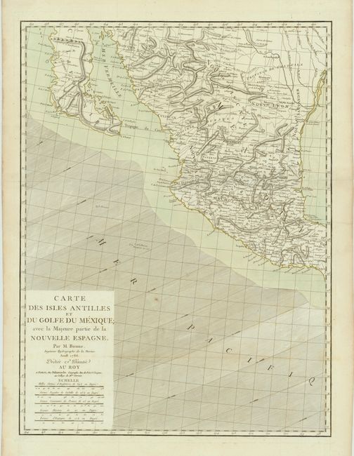
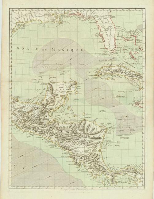
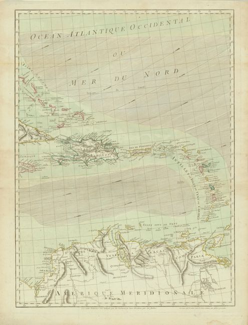
"[3 Sheets] Carte des Isles Antilles et du Golfe du Mexique; avec la Majeure partie de la Nouvelle Espagne", Bonne, Rigobert

Subject: Gulf of Mexico, Florida and Caribbean

Period: 1786 (dated)

Publication:

Color: Hand Color

Size:
19.5 x 26 inches
49.5 x 66 cm
Download High Resolution Image
(or just click on image to launch the Zoom viewer)

This very scarce three-sheet map details the coastlines of Central America, southern United States, the Caribbean, and northern South America. The first sheet includes the title and shows the Pacific coast from Mazatlan north to Sonora, including Baja California and Cape S. Lucas, and the Gulf of Mexico from Vera Cruz to the Red River. The second sheet features the southern coastline of the United States from Corpus Christi, TX to Florida, along with Cuba, the Bahamas, and the southern half of Central America. The third sheet centers on the remainder of the Caribbean and northern South America. The maps are beautifully engraved with detail of the provinces, towns, and forts inland and considerable navigational information including trade-wind direction in the oceans. Each chart stands on its own with complete borders (size given is for each sheet). This is the second state, published by Delamarche.

References: Sellers & Van Ee #1703; cf Lowery, W. 648.

Condition: A

Fine impression and original color with full wide margins. Folded, as issued. There are some damp stains, minor repaired tears, and soil in the blank margins, else very good.

Estimate: $1,800 - $2,200

Unsold

Closed on 9/14/2011

Archived