Catalog Archive
Auction 137, Lot 423

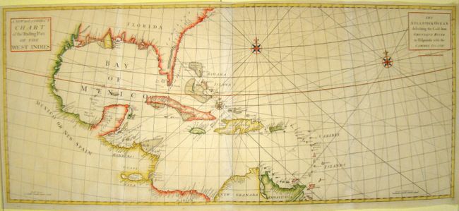
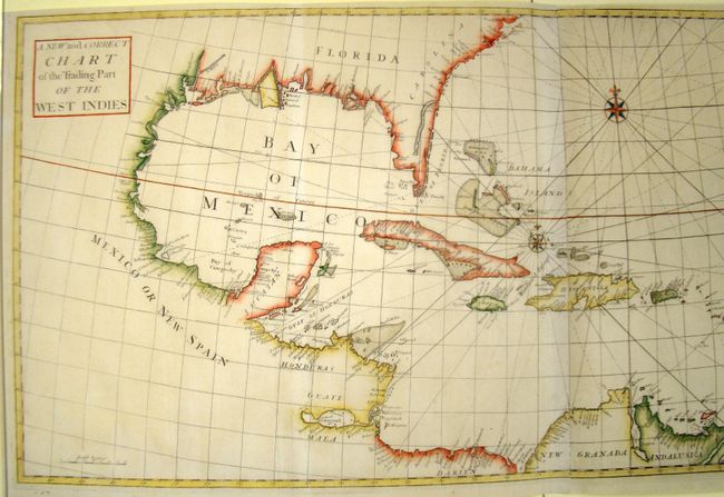
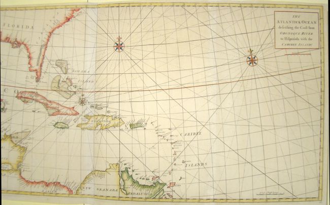
"A New and Correct Chart of the Trading Part of the West Indies / The Atlantick Ocean Describing the Coast from Oronoque River to Hispaniola with the Caribee Islands", Senex, John

Subject: Gulf of Mexico and Caribbean

Period: 1728 (published)

Publication: Atlas Maritimus & Commercialis

Color: Hand Color

Size:
46 x 20 inches
116.8 x 50.8 cm
Download High Resolution Image
(or just click on image to launch the Zoom viewer)

This map was originally issued as two separate sheets in Atlas Maritimus & Commercialis by John Senex, Nathaniel Cutler, Edmond Halley, John Harris, and Henry Wilson. The atlas was created to compete with Mount & Page's English Pilot, but did not achieve the same commercial success. Halley is credited with being the first to use isogonic lines on a map, which represent the magnetic declination on a compass to measure longitude more accurately. He used this technique to determine the exact locations of islands in the Atlantic. This scarce chart depicts the West Indies from the Bahamas to Trinidad, the Gulf coast, part of Mexico, Central America and the northern coast of South America. The southern tip of the Florida peninsula is depicted as several large islands, and an exaggerated St. John's River is shown. The map provides excellent coastal and navigational information and no interior details. The handsome chart includes three compass roses and rhumb lines. Two sheets, joined.

References: Phillips, P.L. (Atlases), #3298.

Condition: A

Expert repairs of a few fold separations and holes, with minor amount of rhumb lines in facsimile.

Estimate: $1,500 - $1,800

Sold for: $1,000

Closed on 9/14/2011

Archived