Catalog Archive
Auction 137, Lot 387

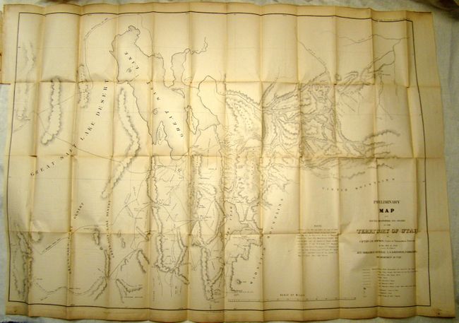
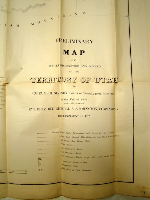
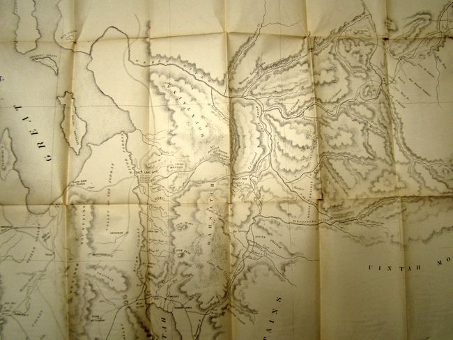
Important map of the Central Overland Trail

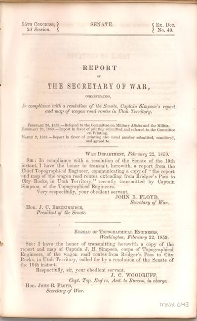
"Preliminary Map of Routes Reconnoitered and Opened in the Territory of Utah…", U.S. War Department

Subject: Utah

Period: 1858 (dated)

Publication: Senate Doc 40, 35th Cong., 2nd Sess.

Color: Black & White

Size:
43 x 30 inches
109.2 x 76.2 cm
Download High Resolution Image
(or just click on image to launch the Zoom viewer)

This large, accurate and carefully drawn map details the portion of Utah from the Great Salt Lake Desert to Fort Bridger, to above the Great Salt Lake and south to below Goshen and Mt. Nebo. Issued shortly after the Utah War the map contains terrific detail of wagon roads, trails, military camps, early settlements and several Mormon Fortifications. These fortifications were built by Mormon settlers in defense against the U.S. Army’s Utah Expedition, to which Captain James H. Simpson was assigned. The map documents Simpson’s important reconnaissance to find an alternate wagon road through Nevada and Utah to California. Simpson’s Central Overland Trail, as it was known, became a vital transportation route, most notably used by the Pony Express and later the Transcontinental Telegraph. This route was nearly 300 miles shorter than the California Trail that followed the Humboldt River. The map also shows the previous routes of Stansbury and Beckwith. The map is accompanied by an 84 pp. octavo report, titled "Report and map of the wagon road routes extending from Bridger's Pass to City Rocks, in Utah Territory." The disbound report describes the various wagon routes explored and gives details of geology, meteorology and Indians.

References: Wheat (TM) #998.

Condition: B+

Ivory age toning. Several short splits at fold intersections with no loss, still very good. Report text is in good condition.

Estimate: $325 - $400

Sold for: $240

Closed on 9/14/2011

Archived