Catalog Archive
Auction 137, Lot 378

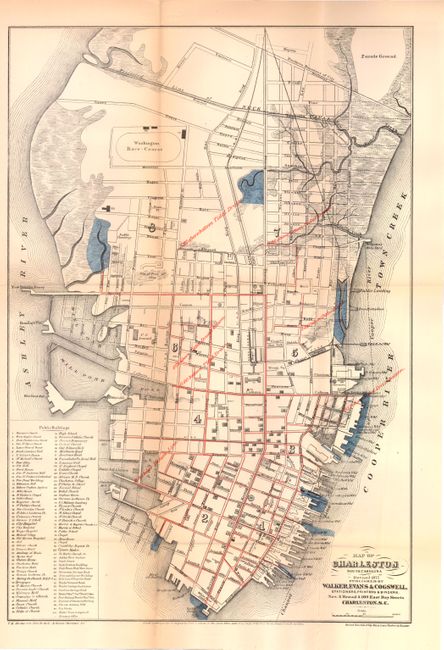
"Map of Charleston South Carolina",

Subject: Charleston, South Carolina

Period: 1877 (dated)

Publication:

Color: Printed Color

Size:
12.5 x 18.5 inches
31.8 x 47 cm
Download High Resolution Image
(or just click on image to launch the Zoom viewer)

This map of the city of Charleston is based on a may by Louis J. Barbot, City Engineer, and a prominent local architect. It was revised by T.H. Abrahams and John H. Sevle, also prominent architects. It shows nice detail of streets, buildings and wharves. An index at lower-left names 100 different public buildings of interest. Red ink is overlaid on the map indicating the elevation of various parts of the city and reveals that part of the city is actually below sea-level. This map is dated 1877 and is a splendid view of the city prior to the devastating earthquake of 1886, which remains the strongest earthquake to ever hit the Southeastern United States (measuring 7.3). Published by Walker, Evans & Cogswell.

References:

Condition: A

Just a hint of toning, else fine.

Estimate: $200 - $250

Sold for: $150

Closed on 9/14/2011

Archived