Catalog Archive
Auction 137, Lot 371

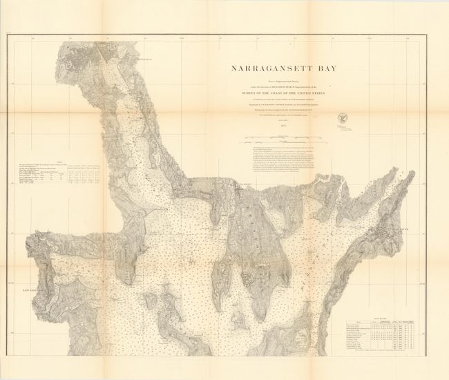
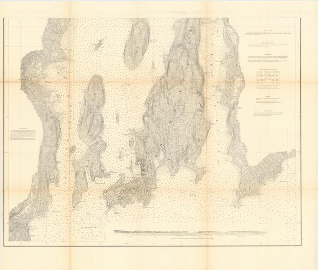
"Narragansett Bay from a Trigonometrical Survey under the Direction of Benjamin Pierce Superintendent…", U.S. Coast Survey

Subject: Rhode Island

Period: 1873 (dated)

Publication:

Color: Black & White

Size:
30.5 x 23.5 inches
77.5 x 59.7 cm
Download High Resolution Image
(or just click on image to launch the Zoom viewer)

The Office of Coast Survey is the oldest U.S. scientific organization, dating from 1807 when Congress directed that a "survey of the coast" be carried out. By 1836, it was called the U.S. Coast Survey and in 1878, the name was changed to the U.S. Coast and Geodetic Survey. Today the Office of Coast Survey is a division of the National Oceanic and Atmospheric Administration NOAA.

The survey teams, composed of civilians as well as Army and Naval officers, charted the nation's waterways and produced a wide array of reports, survey charts, hydrographic studies of tides and currents, astronomical studies and observations, and coastal pilots. These charts are an important record of the changing nature of the nation's coastlines. In additional to coastal charts, the U.S. Coast and Geodetic Survey produced land sketches, Civil War battle maps, and the early aeronautical charts.

Two large sheets provide an excellent examination of the bay, with an abundance of detail. Street plats are shown for East Greenwich, Providence, Bristol, Fall River and Newport. At bottom is a profile view of the bay's approach and Beavertail Light. Separate notes and tables provide details on 14 light houses, Light Vessel, Magnetic Variation, Soundings, and Buoys. Twenty-one different sea bottoms are identified. Two sheets unjoined, as issued.

References:

Condition: B+

There are a few splits at fold intersections, typical for this type of map, along with some minor toning.

Estimate: $350 - $450

Sold for: $190

Closed on 9/14/2011

Archived