Catalog Archive
Auction 137, Lot 324

Early Automobile Road Map

"Map of the Coast of Maine [Eastern Part]", Walker, George H. & Co.
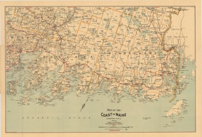
Subject: Maine

Period: 1905 (dated)

Publication:

Color: Printed Color

Size:
31 x 21 inches
78.7 x 53.3 cm
Download High Resolution Image
(or just click on image to launch the Zoom viewer)

This is an extremely early automobile road map that shows the 'Best Routes' in red overprinting. The map shows the coast from Lincolnville east to Eastport, on the border with New Brunswick. The map details a surprising number of routes for the newly mobile horseless carriage owners. The map is copyrighted 1893 and 1905; updated to show the automobile routes. Folds into pictorial paper covers featuring images of the region. A list of maps available from the company begins on the inside front cover and extends to the back cover . The list includes city plans, pocket railroad maps, bird's-eye views, and road maps. This map is shown with a price of $0.25.

The automobile was first manufactured in the United States by the Duryea Motor Wagon Company in 1893, and by 1901 Oldsmobile produced 425 automobiles. The Ford Motor Company, which was organized in June 1903, produced 1,700 cars during its first full year of business. The existing bicycle and railroad maps did not serve well for this new form of transportation and maps were needed to identify roads suitable for automobiles; roads with adequate gravel, bridges, gasoline and repair shops. The American Automobile Association produced the first maps specifically for automobiles in 1905 and the George H. Walker Co. (aka Walker Lith. & Pub. Co.) quickly followed suit.

References:

Condition: A

Two small splits at fold intersections, else fine.

Estimate: $100 - $150

Sold for: $75

Closed on 9/14/2011

Archived