Catalog Archive
Auction 137, Lot 313

"Map of Hawaii, the Largest of the Sandwich Islands; Improved from Vancouver's Survey", Ellis, A.G.
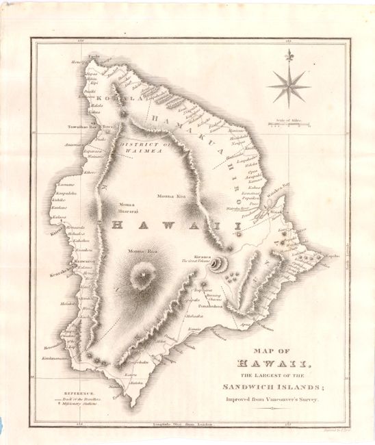
Subject: Hawaii

Period: 1827 (circa)

Publication: Narrative of a Tour Through Hawaii

Color: Black & White

Size:
7.4 x 9 inches
18.8 x 22.9 cm
Download High Resolution Image
(or just click on image to launch the Zoom viewer)

This is the first European map to depict the volcanoes on Hawaii, which was published in the English edition of Ellis' Narrative. Kilauea, here called "Kirauea The Great Volcano," is clearly illustrated with a reference to "Burning Chasms" just south of the volcano, which was the first cartographic indication that the volcanic activity on the island extended to more than one location. Another interesting feature on this map is the hachuring technique used to illustrate the topography, which gives the impression of mountain ridge lines and interior valleys, topographical features that actually do not exist on the island. Ellis did correctly describe the physical appearance of the island in his Narrative. The map also shows missionary stations, roads anchorages, and good coastal detail. Engraved by J. Tyrer and published in London by H. Fisher, Son & P. Jackson.

References: Fitzpatrick #48.

Condition: A

Folding as issued on watermarked paper, with a couple of very faint stains in blank area of map image on right-hand side that do not distract.

Estimate: $250 - $350

Sold for: $275

Closed on 9/14/2011

Archived