Catalog Archive
Auction 137, Lot 305

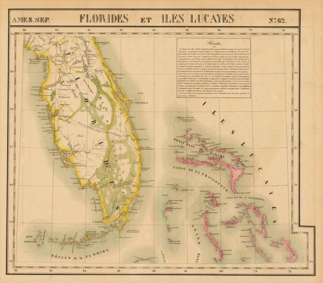
"Amer. Sep. Florides et Iles Lucayes. No. 62", Vandermaelen, Philippe Marie Guillaume

Subject: Florida & Bahamas

Period: 1825-27 (published)

Publication: Atlas Universel

Color: Hand Color

Size:
21.6 x 18.5 inches
54.9 x 47 cm
Download High Resolution Image
(or just click on image to launch the Zoom viewer)

This graphic, large-scale map features Southern Florida and the Bahamas, including good detail of the Keys. The map is filled with topographical information, forts, Indian villages, early roads, the Indian Trail traversing the peninsula, and a notation on the Everglades.

The Atlas Universel was the first atlas to present all the maps on the same scale (1: 1,641,836), with each map covering an area of approximately 20 degrees longitude (from Paris) and 6 degrees of latitude. It was also considered to be the first lithographic atlas ever published. There was only one edition, published in 1825-27, with approximately 810 copies sold.

References:

Condition: B+

Original outline color with some faint offsetting and toning in blank margins, still very good.

Estimate: $900 - $1,100

Unsold

Closed on 9/14/2011

Archived