Catalog Archive
Auction 137, Lot 294
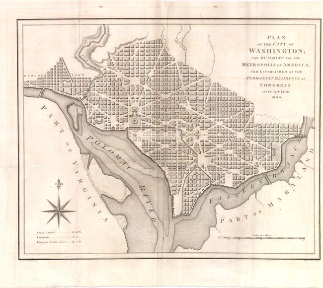
"Plan of the City of Washington; Now Building for the Metropolis of America, and Established as the Permanent Residence of Congress after the Year 1800", Baker, Benjamin
Subject: Washington, D.C.
Period: 1793 (dated)
Publication: Universal Magazine
Color: Black & White
Size:
13.5 x 10.8 inches
34.3 x 27.4 cm
Download High Resolution Image
(or just click on image to launch the Zoom viewer)
(or just click on image to launch the Zoom viewer)