Catalog Archive
Auction 137, Lot 292

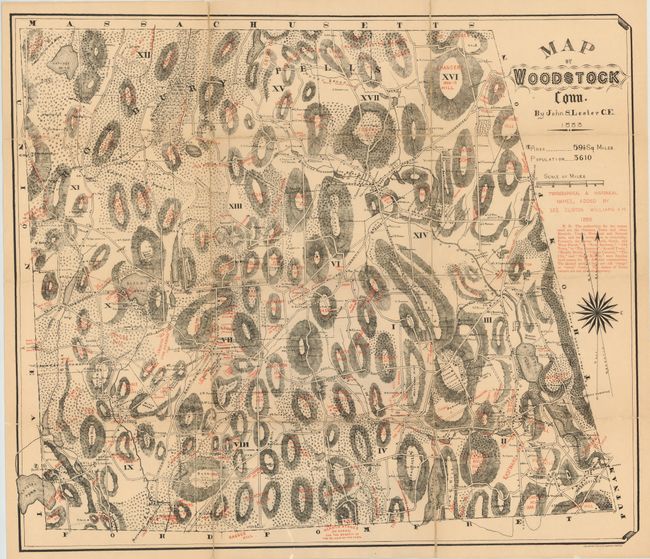
"Map of Woodstock Conn.", Lester, John S.

Subject: Connecticut

Period: 1883 (dated)

Publication:

Color: Printed Color

Size:
28 x 24 inches
71.1 x 61 cm
Download High Resolution Image
(or just click on image to launch the Zoom viewer)

This is a map of Woodstock, Connecticut located in northeastern Connecticut, close to the Massachusetts border. The map shows detail of roads, property ownership and tremendous relief detail through hachure. In the seventeenth century, Woodstock was one of the largest "praying towns" in the area, where Native Americans embraced Christianity and were expected to renounce their religious ceremonies and customs.

References:

Condition: B+

The map is backed with linen to both support and repair some fold separations. Light uniform toning.

Estimate: $180 - $220

Sold for: $90

Closed on 9/14/2011

Archived