Catalog Archive
Auction 137, Lot 288

"N. America West Coast - San Francisco Harbour", British Admiralty

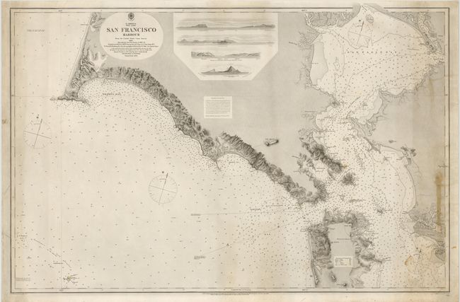
Subject: San Francisco, California

Period: 1869 (dated)

Publication:

Color: Black & White

Size:
38.3 x 25 inches
97.3 x 63.5 cm
Download High Resolution Image
(or just click on image to launch the Zoom viewer)

Very large rare chart of San Francisco Bay, extending to Point Reyes in the northwest, Vallejo in the northeast, Alameda in the southeast, and the Farallone Islands in the southwest. The chart is based on the US Coast Survey chart of 1856 shortly after the discovery of Gold in California. It was first published in 1860 and has been corrected to 1869 to reflect additional surveys in 1860-62. There is great detail of the coastline from San Francisco to Point Reyes with the use of hachuring along the coast. There are at least 2,000 soundings in San Francisco Bay and the Pacific, as well as 4 profile views from the ocean approach.

References:

Condition: B

Bright example on heavy paper. There is some light soiling and stains primarily on the right side of the image, else very good.

Estimate: $1,000 - $1,300

Unsold

Closed on 9/14/2011

Archived