Catalog Archive
Auction 137, Lot 273

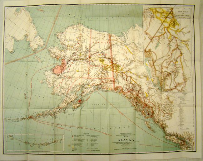
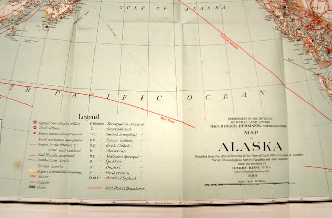
A Remarkable Record of the Great Alaskan Gold Rush

"Map of Alaska [with] Annual Reports of the Department of Interior for the Fiscal Year Ended June 30, 1901…", General Land Office

Subject: Alaska

Period: 1898 (dated)

Publication:

Color: Printed Color

Size:
32 x 25 inches
81.3 x 63.5 cm
Download High Resolution Image
(or just click on image to launch the Zoom viewer)

This is a large and colorful map of Alaska Territory, published at the beginning of the Yukon Gold Rush and featuring a large inset of the gold region titled "From Juneau to Forty-Mile Creek." A legend identifies regions with reported gold discoveries (highlighted in yellow), deposits of silver, copper and coal, church locations, and routes of the railroads (both existing and proposed). Another inset details the Aleutian Islands. Large text box provides distances from the U.S. to locations throughout Alaska, e.g. San Francisco to Chilkoot Pass - 1186 miles. Steam ship routes from San Francisco plus internal mail routes are shown in overprinted colors. Compiled and drawn by M. Herdges under the direction of Harry King, Chief of Drafting Division. Accompanied by an 88 pp. report with 4 photographic plates and two folding sections of gold mines.

References: Phillips (M) p. 117.

Condition: A+

Map is in excellent condition (code is for the map). Folded as issued. Report is disbound but pages are clean.

Estimate: $150 - $200

Sold for: $110

Closed on 9/14/2011

Archived