Catalog Archive
Auction 137, Lot 26

"Orbis Terrae Compendiosa Descriptio…forma a Hieronymo Porro Redacta", Magini and Porro
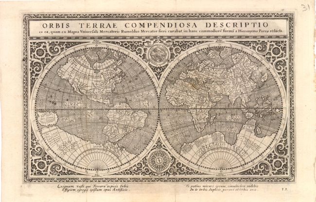
Subject: World

Period: 1596 (circa)

Publication: Geographicae Universae

Color: Black & White

Size:
9.5 x 6 inches
24.1 x 15.2 cm
Download High Resolution Image
(or just click on image to launch the Zoom viewer)

This intricately engraved double-hemisphere map was based on Rumold Mercator's 1587 world map and was re-engraved in a reduced format by Girolamo Porro. The amount of detail that has been retained from the larger map is astonishing. The map is surrounded by an elaborate strapwork border, and an armillary sphere and 32-point compass rose are tucked between the hemispheres. The North Pole is depicted as a landmass surrounding a sea from which four rivers radiate and there is a well depicted Northwest Passage. The huge Terra Australis is shown as a part of Tierra del Fuego, and the lands of Lucach, Maletur and Beach (from the travel account of Marco Polo) are noted along the coast in the vicinity of present day Australia with a large island labeled Iava Minor located in the same region. Japan is shown in a kite-shaped configuration, with the fictitious Satyrorum insule (Satyr's Island) shown above. South America has a bulge on its southwest coast, and New Guinea is depicted in a large, circular configuration. The map embodies many ancient authorities and is a wonderful view of classical cartography.

References: Shirley, #194.

Condition: B+

Light toning along folds, with short fold separations that do not enter map image.

Estimate: $950 - $1,100

Sold for: $500

Closed on 9/14/2011

Archived