Catalog Archive
Auction 137, Lot 267

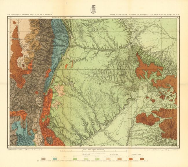
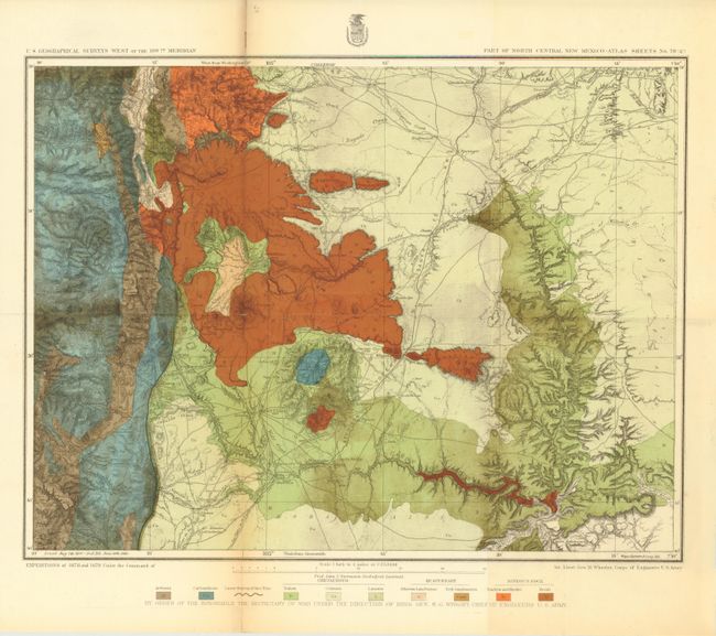
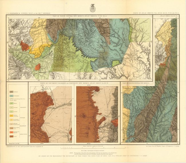
"Report upon United States Geographical Surveys West of the One Hundredth Meridian...Geological Examinations in Southern Colorado and Northern New Mexico, During the Years 1878 and 1879…", Wheeler, George (Lt)

Subject: Colorado, New Mexico

Period: 1881 (dated)

Publication:

Color: Printed Color

Size:
21.5 x 19 inches
54.6 x 48.3 cm
Download High Resolution Image
(or just click on image to launch the Zoom viewer)

The 1870s was a period of intense effort, by such prominent people as Clarence King, Ferdinand Hayden, and John Wesley Powell, to advance the geographical knowledge of the West. These various surveys presented a threat to the Army's supremacy in the field of mapping and to the related appropriations from Congress. As a result of these pressures, the Army Corp of Engineers developed a plan to systematically survey the entire West to be called the U.S. Geographical Surveys West of the One Hundredth Meridian. The region was divided up into 95 rectangles, with atlas sheets to be prepared for each, comprising an area 2°45' of longitude and 1°40' of latitude on a scale of eight miles to the inch. Lieutenant George Wheeler was chosen to head this immense project. Surveys were conducted each summer from 1872 to 1878, after which Congress cut off appropriations for field work; thus the survey was not completed as originally envisioned. Wheeler published annual reports from 1873 to 1884, as well as the final Geographical Report published in 1889. The maps from this report are a valuable document of the record of Western exploration.

This is the complete Volume III (Supplement - Geology) of Wheeler's Survey dated 1881. This scarce volume contains the first detailed mapping of the region from Trinidad, Colorado to Los Alamos, New Mexico. Included are three maps with both topographical and geological information: Parts of Southern Colorado and Northern New Mexico, No. 70A; Part of North Central New Mexico, No. 70C; Parts of Atlas Sheets No. 69B, 69D, 77B and 78A. Each of the maps shows different geologic formations in vibrant color that are overlaid on top of relief shown in hachure. In addition to the maps are 4 plates showing geology and fossils along with an accompanying 420 pp. report (10 x 12"). Hardbound in original brown cloth and gilt-lettered spine.

References:

Condition: B+

Maps are bright and clean. There are some clean fold separations in the images and a hint of toning. The covers are bumped and the front cover is loose, but pages are clean and tight.

Estimate: $600 - $800

Sold for: $300

Closed on 9/14/2011

Archived