Catalog Archive
Auction 137, Lot 259

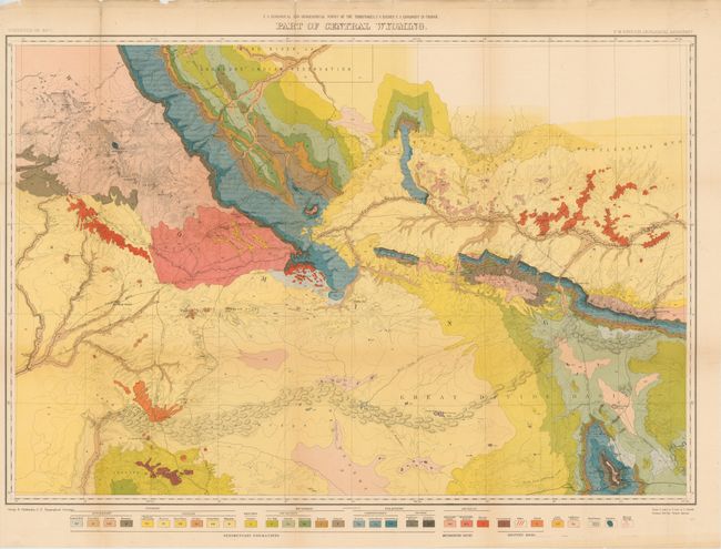
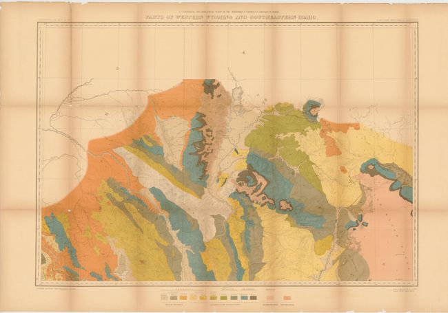
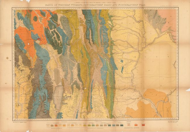
Great Maps from Hayden’s Geological and Geographical Survey of the Territories

"[Lot of 3] Part of Central Wyoming [and] Parts of Western Wyoming and Southeastern Idaho [and] Parts of Western Wyoming, Southeastern Idaho and Northeastern Utah", Hayden, Ferdinand Vandeveer

Subject: Western United States, Wyoming, Idaho, Utah

Period: 1877-78 (dated)

Publication:

Color: Printed Color

Size:
33 x 23 inches
83.8 x 58.4 cm
Download High Resolution Image
(or just click on image to launch the Zoom viewer)

A. Part of Central Wyoming. A very detailed map that displays the full course of the Sweetwater River, South Pass, etc. and depicts trails throughout the region. Wheat draws attention to the map's value to students of the Fur Trade and overland immigration routes. Remarkable detail is shown with contour intervals at 200 feet and a scale of 4 miles = 1 inch. The map extends from part of the Wind River Reservation south to Rawlins. Old wagon roads, trails and the Union Pacific Railroad are featured. A color and pattern code at the bottom provides the key to the 32 different geologic types. Condition - Nice bright color with a few repaired fold separations and a few splits at fold intersections. (B+)

B. Parts of Western Wyoming and Southeastern Idaho. This colorful map is centered on today's Jackson Hole, Wyoming and extends to show good detail of Jenny and Leigh lakes, but the area of Yellowstone National Park is completely blank. Names John Gray's Lake, the Blackfoot River, Caribou Mt., Fremont's Pk., To-gwo-tee-a Pass, and much more. It provides a detailed examination of the Snake River and Blackfoot Range in Idaho and the Gros Ventre Mountains and part of the Wind River Range in Wyoming. Condition - Some fold separations and intersection splits have been repaired with archival material on verso. Light toning with a tiny bit of loss at a couple of fold intersections. (B+)

C. Parts of Western Wyoming, Southeastern Idaho and Northeastern Utah. Very detailed sheet shows all land from the Green River Basin in the east to the Bear River Range to the west. Maps the Aspen Range, Salt River Range and the Wyoming Range in the north, and extends south below Bear Lake to Logan. Locates numerous settlements and includes Fremont’s Lake. Condition - Some fold separations and intersection splits have been repaired with archival tape on verso. Light toning with a tiny bit of loss at a couple of fold intersections. (B)

References: Wheat (TMW) #1296.

Condition:

See descriptions.

Estimate: $550 - $700

Sold for: $500

Closed on 9/14/2011

Archived