Catalog Archive
Auction 137, Lot 256

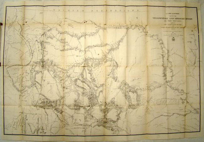
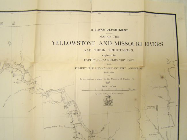
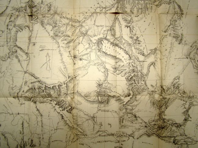
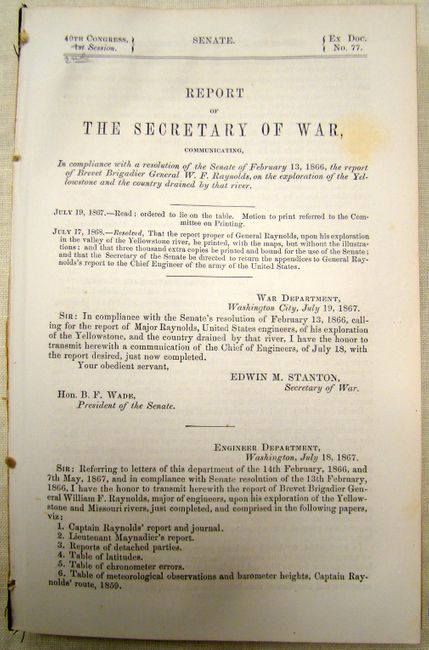
"Map of the Yellowstone and Missouri Rivers and Their Tributaries [with] Report on the Exploration of the Yellowstone River…", U.S. War Department

Subject: Western United States

Period: 1867 (dated)

Publication:

Color: Black & White

Size:
41 x 27 inches
104.1 x 68.6 cm
Download High Resolution Image
(or just click on image to launch the Zoom viewer)

A large and very detailed map of the region explored by Capt. W.F. Raynolds in 1859-60. His report was delayed until 1866 due to the outbreak of the Civil War which sent him and his assistants off to war. While he was away, he came down with a "severe and protracted illness" which caused further delays. It was eventually completed when mining developments and conflicts with Indian tribes in the region made it important. The map includes post 1860 developments such as Ft. Casper and Camp Marshall on the upper North Platte, as well as the Tetons, Jackson's Hole, and several new forts and emigrant roads. Included with the map is the disbound 174 pp. "Report on the exploration of the Yellowstone River...Communicated by the Secretary of War, in compliance with a resolution of Senate, February 13, 1866 (6 x 9").

References:

Condition: B

There are some splits at fold intersections and a few fold separations that extend just into the image. A few stains are also in the image, else very good. Report is complete with clean pages.

Estimate: $500 - $600

Sold for: $375

Closed on 9/14/2011

Archived