Catalog Archive
Auction 137, Lot 226
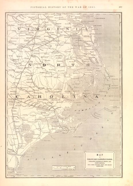
"Map of Pamlico and Albemarle Sounds, Embracing Portions of Virginia and North Carolina…", Colton, George Woolworth
1 of 2
Subject: Virginia, North Carolina, Civil War
Period: 1896 (circa)
Publication: Frank Leslie’s Pictorial History of the War of 1861
Color: Black & White
Size:
14 x 20 inches
35.6 x 50.8 cm
Download High Resolution Image
(or just click on image to launch the Zoom viewer)
(or just click on image to launch the Zoom viewer)