Catalog Archive
Auction 137, Lot 184

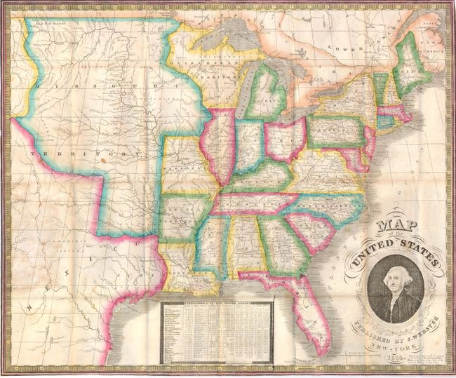
"Map of the United States", Phelps, Humphrey

Subject: Eastern United States

Period: 1835 (dated)

Publication:

Color: Hand Color

Size:
19.5 x 16.3 inches
49.5 x 41.4 cm
Download High Resolution Image
(or just click on image to launch the Zoom viewer)

This is a scarce pocket map published by James Webster from Humphrey Phelps' plate of 1832. Phelp's name has been erased and Webster's has been added on the lower right. George Washington's portrait decorates this map along with a chart of the population of the United States in 1830. The map shows a large Missouri Territory reaching from Missouri and stretching to the Rocky Mountains. Wisconsin (here named Ouisconsin) Territory is massive and includes the Upper Peninsula of Michigan and a portion of Minnesota. Arkansas gained statehood the year this map was published, but it is still shown as a territory. Texas is named and included as part of Mexico. The map folds into original blue paper covers (3.5 x 5.3"). The folding "Traveller's Guide and Statistical View of the United States" (22 x 17.8") attaches to front cover.

References:

Condition: B+

This is a brightly colored map with some light toning and staining. There are a few tiny splits along the folds which have been repaired with archival tape on verso. The map is issued folded and is separated from the covers.

Estimate: $500 - $600

Sold for: $500

Closed on 9/14/2011

Archived