Catalog Archive
Auction 137, Lot 176

"Map Showing Indian Reservations within the Limits of the United States Compiled under the Direction of the Hon. T.J. Morgan", U.S. Government

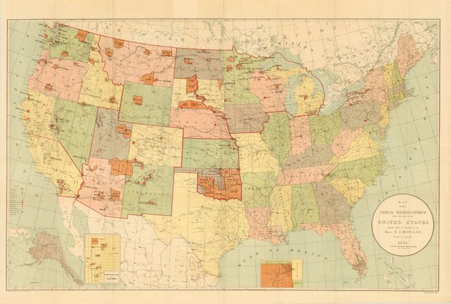
Subject: United States, Indian Reservations

Period: 1891 (dated)

Publication:

Color: Printed Color

Size:
33 x 20.8 inches
83.8 x 52.8 cm
Download High Resolution Image
(or just click on image to launch the Zoom viewer)

As western migration reached its height in the latter part of the end of the nineteenth century, the government directed much of its resources to solving what was known as the Indian Problem. The Native Americas were gradually confined to a huge network of Indian Reservations throughout much of the western United States. In addition there was a concerted effort to provide education that would result in the 'civilization' of the tribes. This over-sized map of the United States focuses on the Indian Reservations that existed in 1891 and shows the extensive network of Indian Schools. Inset maps are included to illustrated regions where the reservation concentration prevents them showing well on the large map: Indian Territory, Mission Indian Reservations in California, and the Territory of Alaska. The legend locates Military Stations, railroads, Indian Agencies, Non-Reservation Schools, Boarding Schools, Day Schools, Contract Schools and Public Schools under contract with the Indian Bureau. Printed by Norris Peters Co.

References:

Condition: B

Folding as issued with some clean fold separations and a closed tear entering 1.5" into the map at left.

Estimate: $150 - $200

Sold for: $160

Closed on 9/14/2011

Archived