Catalog Archive
Auction 137, Lot 142

One of the Most Unusual French & Indian War Period Maps

"Carte des Possessions des Anglois en Amerique, par Rapport a Leurs Differends avec la France", Back, Jean C.

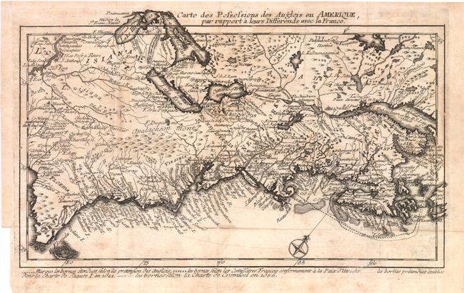
Subject: Colonial United States and Canada

Period: 1759 (circa)

Publication: Le Point d'Appui entre la Hollande et l'Angleterreā€¦

Color: Black & White

Size:
11.8 x 7 inches
30 x 17.8 cm
Download High Resolution Image
(or just click on image to launch the Zoom viewer)

This rare and highly unusual map depicts the east coast of North America, from mountainous Florida north to Nova Scotia. It has an unusual oblique orientation with north to the upper-right. The map is filled with uncommon and historical place names, Indian tribes, watershed, and political boundaries. In New England and Canada, the disputed claims of the British and French are shown in a variety of dotted and dashed lines dictated by Treaty of Utrecht. This rare map has only been on the market once in the last 20 years.

References:

Condition: B

Some light staining and a tiny split at one fold intersection. Binding trim at left.

Estimate: $450 - $600

Sold for: $475

Closed on 9/14/2011

Archived