Catalog Archive
Auction 137, Lot 109

"Americque Septentrionale par le Sr. Sanson d'Abbeville Geographe du Roy", Sanson, Nicolas

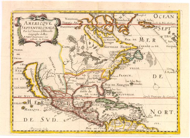
Subject: North America

Period: 1705 (dated)

Publication:

Color: Hand Color

Size:
10.8 x 7.8 inches
27.4 x 19.8 cm
Download High Resolution Image
(or just click on image to launch the Zoom viewer)

This is a reduced and revised version of Sanson's important map of North America (1650). The map was originally engraved by A. Peyrounin in 1657 and there were several editions. This edition has been updated with a number of significant improvements. It still shows California as an island with a nearly flat northern coast, with a coastline of Terre de Iesso to the west. All five Great Lakes are now complete and there is a new system of lakes to the west of the redrawn Hudson Bay. Lac des Sioux forms the source of the Mississippi River which winds its way considerably too far west and empties into the gulf in present-day Texas. Most significantly, the Rio Grande River (here unnamed) is correctly shown emptying into the Gulf of Mexico rather than the Gulf of California. The Apaches are shown to dominate Nouveau Mexique. The British colonies are shown simply as Nouvelle Angleterre and Virginie. This is the fifth state.

References: Burden #324; McLaughlin #18.

Condition: A

A few printer's creases.

Estimate: $1,200 - $1,500

Sold for: $850

Closed on 9/14/2011

Archived