Catalog Archive
Auction 136, Lot 97

"Amerique Septentrionale", Bonne, Rigobert

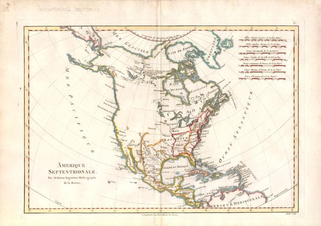
Subject: North America

Period: 1790 (circa)

Publication: Raynal's Atlas de toutes les parties connues du globe terrestre

Color: Hand Color

Size:
13.5 x 9.2 inches
34.3 x 23.4 cm
Download High Resolution Image
(or just click on image to launch the Zoom viewer)

Map of North America with the United States (unnamed) confined east of the Mississippi River. Virginia, the Carolinas and Georgia extend to the Mississippi. Much of the western part of the continent is blank, but additional detail has been added to the west of the Hudson Bay. Based upon the discoveries of Samuel Hearne, L. Arathapescow, L. Cogead and other additional detail appear in this map. This was where Cook would be sent a few years later in an attempt to find a Northwest passage. Based upon Cook's various explorations, Alaska is now roughly the correct shape despite its orientation being too far to the north.

References: cf Seller & Van Ee #170.

Condition: A

Minor toning in margin, else fine.

Estimate: $120 - $150

Sold for: $90

Closed on 6/1/2011

Archived