Catalog Archive
Auction 136, Lot 88

Influential map showing the Island of California

"America Septentrionalis", Hondius/Jansson

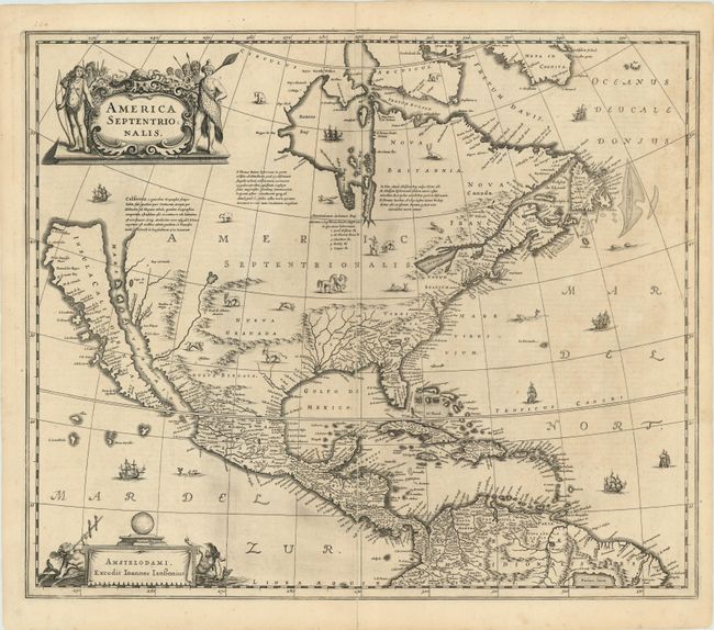
Subject: North America

Period: 1644 (circa)

Publication:

Color: Black & White

Size:
22 x 18 inches
55.9 x 45.7 cm
Download High Resolution Image
(or just click on image to launch the Zoom viewer)

Due to its wide distribution by one of the preeminent Dutch mapmakers, this important map of North America had great influence in perpetuating the theory of California as an island . The map is a careful compilation of various sources and represents the state of cartographic knowledge at the time. The insular California is derived directly from Henry Briggs, as is the depiction of the Arctic. A great number of place names are revealed on California, including po. de S. Diego (San Diego) and Po. Sir Francisco Draco (San Francisco). The Rio del Norto (Rio Grande) originates in a large western lake and flows incorrectly into the Mare Vermio (Gulf of California). The cartography of the Gulf of Mexico and Florida is based on Hessel Gerritsz. On the east coast the region identified as Novum Belgium is greatly elongated; Iames Towne and a few place names from John Smith's map appear in Nova Anglia. There is a single Lac des Iroquois in the Great Lakes region. The map is richly embellished with a variety of animals throughout the interior. The oceans are teeming with ships and sea monsters. The title cartouche features several Native Americans and two comely mermaids flank the imprint cartouche. This is the second state with Jansson's imprint. French text on verso.

References: Burden #245; McLaughlin #6; Tooley (Amer) #6, pl. 28; Goss (NA) #30.

Condition: A

Nice impression printed on sturdy paper with just a hint of toning at upper right side. Light tissue repair on verso of the centerfold.

Estimate: $3,000 - $4,000

Sold for: $3,250

Closed on 6/1/2011

Archived