Catalog Archive
Auction 136, Lot 83

"Tableau General de l'Amerique, comprenant les principales Regions qui composent cette partie du Monde…", Brion de la Tour/Desnos

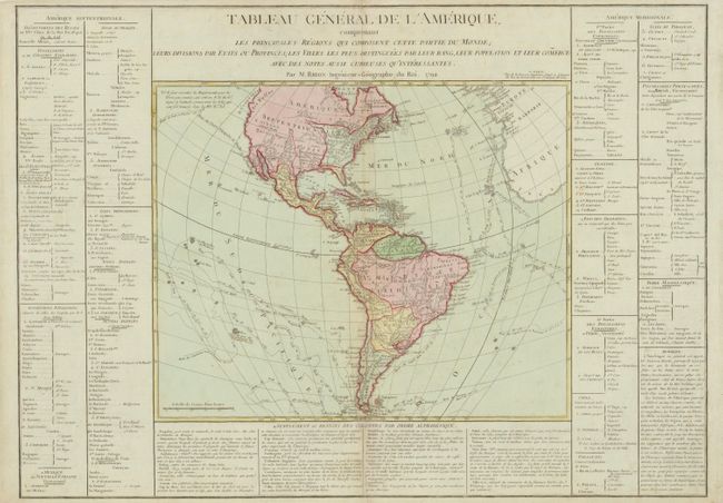
Subject: Western Hemisphere - America

Period: 1792 (dated)

Publication:

Color: Hand Color

Size:
17.4 x 14 inches
44.2 x 35.6 cm
Download High Resolution Image
(or just click on image to launch the Zoom viewer)

This interesting map of the Americas provides a detailed view of the colonial possessions and the most recent explorations. The new United States is shown with its boundary on the Mississippi River. The coloring shows Florida under Spanish control, with the balance of the continent belonging to the British - including California! However, the text indicates the British colonies confined to Canada with Spain in possession of everything west of the Mississippi River. The Northwest coast of North America is labeled Decouvertes des Russes and is largely blank in the interior. South America is divided up between Spain and Portugal with Holland and France retaining colonies in Guyana. Terre Magellanique appears to be the last bastion controlled by the Sauvages. Numerous exploration routes are charted including those of Cook, Bougainville, and Biron and the Spanish Manila to Acapulco route is shown. The map is surrounded on three sides with panels of French text on a sheet measuring 28.5 x 20.5". Printed on the bluish toned paper that was common in France during this period.

References:

Condition: B+

Original color with minor toning along centerfold.

Estimate: $275 - $375

Unsold

Closed on 6/1/2011

Archived