Catalog Archive
Auction 136, Lot 792

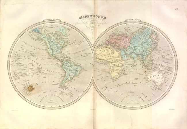
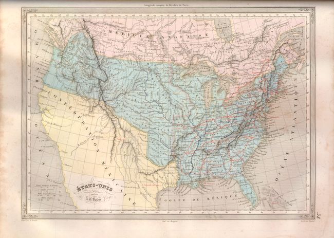
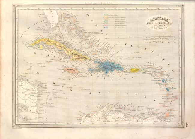
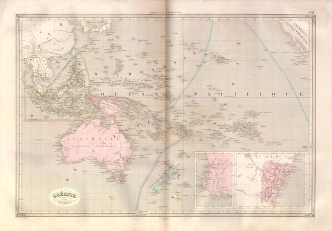
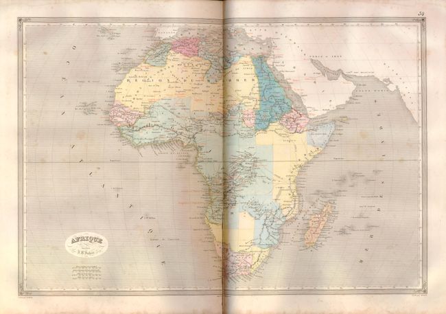
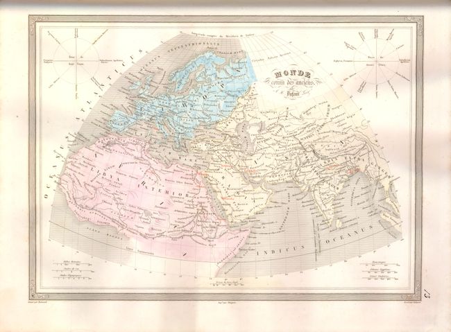
"Atlas Historique et Universel de Geographie Ancienne, du Moyen-Age et Moderne", Dufour/Duvotenay

Subject: Atlases

Period: 1840 (dated)

Publication:

Color: Hand Color

Size:
12.3 x 16.3 inches
31.2 x 41.4 cm
Download High Resolution Image
(or just click on image to launch the Zoom viewer)

Complete folio atlas containing 44 maps including 16 historical and 28 modern maps. This atlas is uncommon as it has four beautifully lettered manuscript pages including the contents page and the header pages for each division of maps: Geographie Ancienne; Geographie du Moyen age; and Geographie Moderne. The original printed contents page is incorrect and has been pasted face-first onto the back of the title page. The modern maps include each continent, numerous European countries, Japan and China, India, Persia, Turkey in Asia, Algeria, Arabia and Egypt, the West Indies, Mexico and Guatemala (Central America), Argentina and Chile, Oceania and a double-page hemispheric map of the world. The world map includes an interesting feature in the Antipodes de Paris (the diametrically opposite location of Paris) with a reverse image of France located just east of New Zealand. Each map carries the embossed stamp "AA" for publisher Armand Aubree and most have oval cartouches with decorative flourishes. The unusual use of red over-printing to highlight cities, transportation networks, and other important features, make this a particularly interesting atlas.

The map of the United States (Etats-Unis Dresses Par A.B. Dufour) shows the Independent Republic of Texas with S. Antonio de Bexar as the capital shown with red overprinting. The northwest is Oregon Territory with a classic Fifty-Four Forty or Fight boundary with U.S. territory extending well into Canada. The Midwest is composed of Indian Territories: Huron occupies Wisconsin, reaching the large District des Sioux at the Mississippi, which itself stretches to the Missouri River. The huge Districe des Mandanes continues from the Missouri River to the Rocky Mountain where it meets Oregon Territory. Further south are the Ozark and Osage districts. The southwest is labeled the Confederation Mexicaine. A good network of early roads, highlighted with red overprinting, extends as far south as Pensacola and west to Lexington in present-day Missouri. The double-page map of North America shows the same configuration.

Title page, hidden contents page, manuscript contents page, 44 maps and three manuscript dividing pages. The title page features a decorative element with two angels holding map making and surveying items with a terrestrial globe above. Hardbound in original quarter leather over green speckled paper boards. A very nice folio atlas with uncommon manuscript pages.

References:

Condition: B

All of the maps are very good with some light toning and occasional foxing except as follows. There are some ink notations on the maps of Central Europe and France. The double-page maps of Europe and Central Europe have clean splits on centerfold about half way, and Europe additionally has a short tear from the centerfold to Malta. Turkey in Europe has a short tear in lower margin just into border. Some scattered foxing or offsetting to Spain & Portugal. Short centerfold split on double-page maps of Asia and Africa, with the latter being a little longer. Binding good with shelf wear and a few abrasions, spine starting to crack.

Estimate: $650 - $800

Sold for: $475

Closed on 6/1/2011

Archived