Catalog Archive
Auction 136, Lot 77

"A New and Accurate Map of America, from the latest Discoveries", Gibson, John

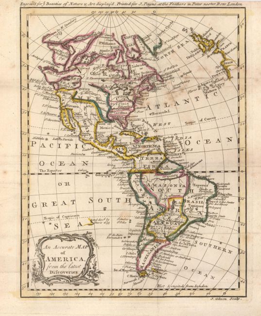
Subject: Western Hemisphere - America

Period: 1764 (published)

Publication: The Beauties of Nature and Art Displayed in a Tour Through the Worl

Color: Hand Color

Size:
6.6 x 8.5 inches
16.8 x 21.6 cm
Download High Resolution Image
(or just click on image to launch the Zoom viewer)

The major focus of the map are the many apocryphal cartographic theories concerning northwest coast of North America. The extravagant Northwest Passage and a huge Sea of the West are included with several notations concerning their discoveries. The Sea of the West, here called the West Sea, is the notation "disc'd by I. Fuca 1592." The northwest portion of North America is ill-defined and gives information on a Russian exploration of Alaska in 1741, and other voyages by M. Spanberg in 1728. The east coast of America names each of the colonies, along with Williamsburg, Ft. Pitt, Savanna, St. Augustine and Boston. Virginia, the Carolinas and Georgia stretch to the Mississippi. There is a large interior Lake des Xarayes in central South America. Spanish South America includes Terra Firma, Amazonia, Peru, Paraguay, Chili and Magellanica. This scarce little map was published by J. Payne in the first edition.

References: McGuirk #119; cf Portinaro and Knirsch plt. CLXX.

Condition: B+

Dark, early impression and original hand color. Folding as issued. Small worm hole visible when held to light and some foxing in the Atlantic.

Estimate: $200 - $275

Sold for: $150

Closed on 6/1/2011

Archived