Catalog Archive
Auction 136, Lot 759

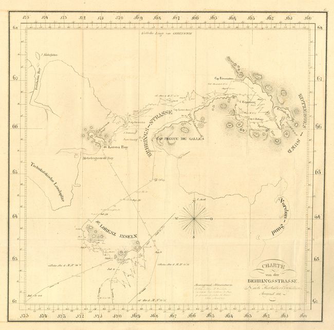
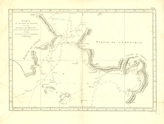
Kotzebue's important map of the Bering Strait

"[Lot of 2 - Bering Strait] Charte von der Behringsstrasse… [and] Carte de l'Entree de Norton, et du Detroit de Bhering…",

Subject: North Pacific, Northern Asia and Northwestern North America

Period: 1785-1816 (circa)

Publication:

Color: Black & White

Size:
See Description
Download High Resolution Image
(or just click on image to launch the Zoom viewer)

1. Charte von der Behringsstrasse. Nach Merkators Projection, by Otto von Kotzebue, from Entdeckungs-Reise in die Sud-See und nach der Berings-Strasse zur Erforschung einer nordostlichen Durchfahrt, dated 1816 (15.2 x 14.8"). This scarce map is based on Kotzebue's exploration of the Bering Strait on the ship Rurick in 1816, which was one of the most important explorations of the northernmost Pacific after Cook. The map identifies St. Lawrence Island, with only the southeast and western parts confidently known, and the Cape Prince of Wales, Cap Prince de Galles. Named for the previous Russian explorer and Kotzebue's mentor, Cape Krusenstern is marked where the national monument now stands. This map appeared in the 1825 Viennese account of his voyage. Ref: Suarez, Fig. 40; Falk, M.W. 1816-3. Condition: Issued folding with light offsetting that does not distract. (B+)

2. Carte de l'Entree de Norton, et du Detroit de Bhering ou l'on voit le Cap le plus Oriental de l'Asie, et la Pointe la plus Occidentale de l'Amerique, by Cook/Benard, circa 1785 (15.2 x 10.4"). French edition of this map from the expedition of Capt. James Cook. It covers the Bering Strait from south of Norton Sound to north of Cap du Prince de Galles and the corresponding coastline of Russia. Features include hachures representing coastal mountains, islands, place names and soundings. St. Lawrence Island, Isles de Clerke, is partially shown. Tracks of both the 1778 and 1779 explorations are delineated; Cook having done the former and Clerke the latter after Cook's death in Hawaii in Feb. 1779. Condition: Issued folding, with a tiny hole at fold intersection. Damp stains on left-hand side and right-hand top corner entering blank area on map image. (B)

References:

Condition:

See descriptions.

Estimate: $1,000 - $1,400

Sold for: $750

Closed on 6/1/2011

Archived