Catalog Archive
Auction 136, Lot 713

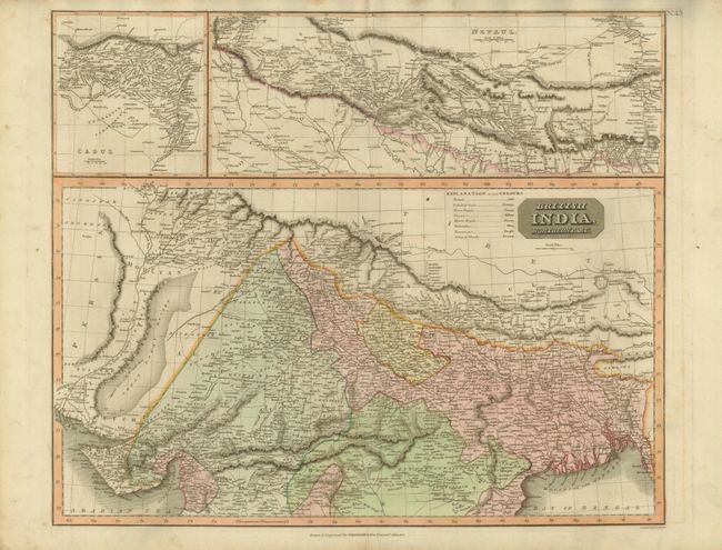
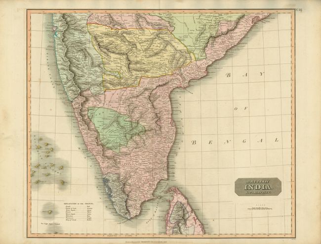
"[Lot of 2] British India, Northern Part. [in set with] British India, Southern Part", Thomson, John

Subject: India

Period: 1816-17 (dated)

Publication: Thomson's New General Atlas

Color: Hand Color

Size:
23.5 x 19.7 inches
59.7 x 50 cm
Download High Resolution Image
(or just click on image to launch the Zoom viewer)

A) British India, Northern Part, dated 1817. This detailed map of northern India distinguishes British and Indian Rajah territories. Two large insets at top cover Cabul and Nepaul.

B) British India, Southern Part, dated 1816. This highly detailed regional map of India also distinguishes British and Indian Rajah territories, and extends from Arungabad, Mahoor and Cicacole in the North, to the southern tip of India, including most of Celyon.

Size varies slightly.

References:

Condition: B+

Original color with light toning and offsetting.

Estimate: $300 - $375

Sold for: $375

Closed on 6/1/2011

Archived