Catalog Archive
Auction 136, Lot 479

"An Accurate Map of the County of Lancaster Divided into its Hundreds…", Bowen, Emanuel
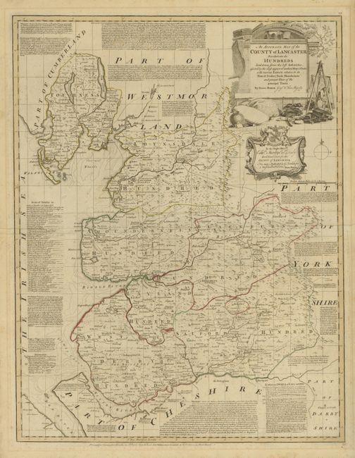
Subject: England

Period: 1752 (circa)

Publication:

Color: Hand Color

Size:
20.8 x 27 inches
52.8 x 68.6 cm
Download High Resolution Image
(or just click on image to launch the Zoom viewer)

This detailed map of the county of Lancaster identifies major roads, hamlets, villages, churches, and castles. The text surrounding the map discusses the history of the Earls and Dukes of Lancaster, the seats of Nobility, and other historical and geographical notes.

References:

Condition: B+

Strong impression with outline color and light foxing. Several small tears in margin not affecting image.

Estimate: $240 - $300

Sold for: $190

Closed on 6/1/2011

Archived