Catalog Archive
Auction 136, Lot 353

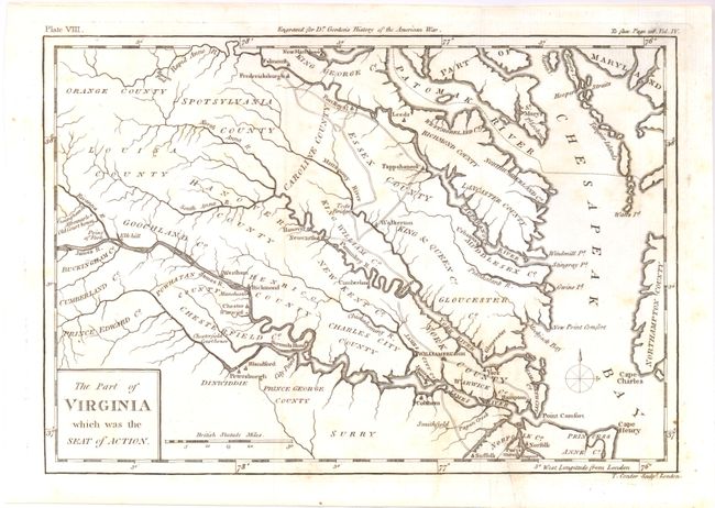
"The Part of Virginia which was the Seat of Action", Conder, Thomas

Subject: Virginia

Period: 1788 (circa)

Publication: William Gordon's History of the Rise, Progress ... of the United States…

Color: Black & White

Size:
10.5 x 7.3 inches
26.7 x 18.5 cm
Download High Resolution Image
(or just click on image to launch the Zoom viewer)

This detailed Revolutionary War map extends from tidewater Virginia back into the Piedmont to Louisa and Orange counties. Derived in part from the Fry & Jefferson map of Virginia and Maryland, it includes part of Maryland and much of the lower Chesapeake Bay. Watershed, islands, courthouses, and some early roads are delineated. Names many towns and settlements including Norfolk, Suffolk, Hampton, Richmond, Hanover, Fredericksburg, Elk Hill, Albemarle Old Courthouse, and Tappahannock. Locates Tod's Bridge, Raccoon Ford, Cape Henry, Point Comfort, etc.

References:

Condition: A

Very nice impression and original margins. Short printer's crease with light soil, otherwise a fine example.

Estimate: $375 - $450

Sold for: $200

Closed on 6/1/2011

Archived