Catalog Archive
Auction 136, Lot 347

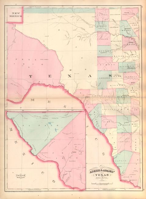
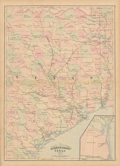
"[Lot of 2] Asher & Adams' Texas Western Portion [and] Asher & Adams' Texas", Asher & Adams

Subject: Texas

Period: 1871-74 (dated)

Publication:

Color: Hand Color

Size:
16.4 x 22 inches
41.7 x 55.9 cm
Download High Resolution Image
(or just click on image to launch the Zoom viewer)

1) This county map of West Texas shows towns, proposed railroad lines, and rivers, including the Colorado River and the Rio Grande. The far western portion of Texas is divided into only three counties: El Paso, Presidio and Bexar. A large inset shows the western border of Texas where it meets Mexico, with El Paso shown on the proposed route of the Texas and Pacific Railroad. The map is dated 1874.

2) This county map of East Texas extends from Louisiana west to beyond San Antonio and features the railway system of the late 19th century. The map features numerous railroads still in their infancy, along with proposed future routes: Houston & Texas Central Railroad; two spurs of the Texas Pacific Railroad; the Gulf, Western Texas and Pacific Railroad; the International Railroad; the Texas & New Orleans Railroad; the Houston & Great Northern Railroad; and the Buffalo Bayou, Brazos & Colorado Railroad, which was the first operating railroad in Texas. A large inset, "Portions of Texas," shows the coastal region between Corpus Christi and Brownsville in more detail. The map is dated 1871.

References:

Condition: B+

Original color. The map of East Texas is lightly toned.

Estimate: $200 - $250

Sold for: $150

Closed on 6/1/2011

Archived