Catalog Archive
Auction 136, Lot 33

"Mappe Monde Suivant la Projection des Cartes Reduites", Robert de Vaugondy, Didier
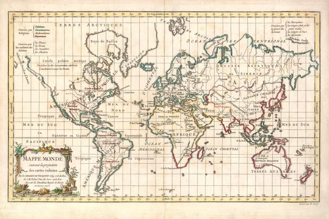
Subject: World

Period: 1778 (dated)

Publication:

Color: Hand Color

Size:
15.5 x 9.7 inches
39.4 x 24.6 cm
Download High Resolution Image
(or just click on image to launch the Zoom viewer)

This boldly engraved world map is drawn on Mercator's projection. Most of the northwest in North America is blank except for a notation and hint of the possible Northwest Passage and apocryphal discoveries of Admiral de Fonte. The island of Tasmania is connected to Australia and the coastline of southeastern Australia is indistinctly drawn, but Cook's discoveries along the eastern coast are shown, and New Zealand appears as two distinctive islands. Tahiti appears within the decorative title cartouche. This interesting map was presented in three thematic versions in the atlas with outline color with coloring to show religion, skin color, and "human shape" as given in the legend at top. In this second state published by Fortin, the coloring indicates the distribution of religions. It has been updated with the recent discoveries, and "et Censeur Royal" was added to the imprint in the cartouche.

References: Pedley #15, McGuirk #106.

Condition: A

Nice strong impression with some light toning.

Estimate: $275 - $350

Sold for: $200

Closed on 6/1/2011

Archived