Catalog Archive
Auction 136, Lot 333

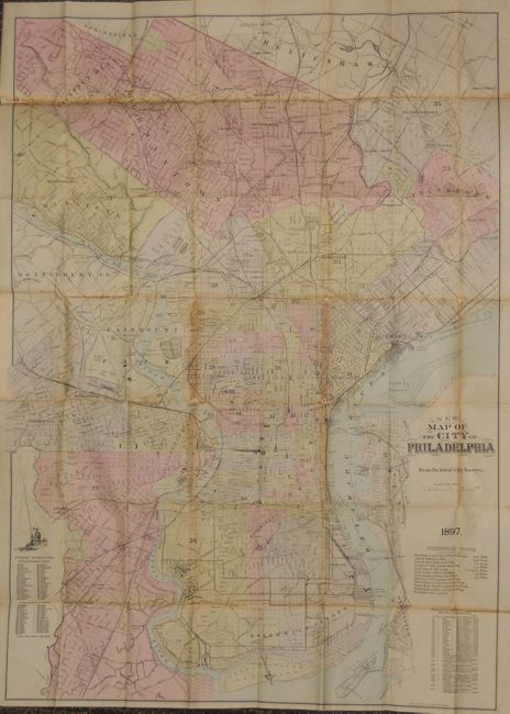
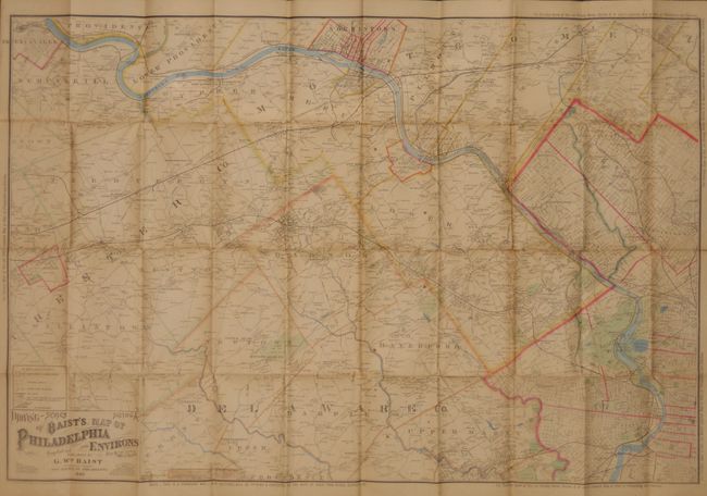
"[Lot of 2] New map of the city of Philadelphia... [and] B. Baist's Driving Map of Philadelphia and Environs",

Subject: Philadelphia, Pennsylvania

Period: 1890-1897 (dated)

Publication:

Color:

Size:
See Description
Download High Resolution Image
(or just click on image to launch the Zoom viewer)

1. New map of the city of Philadelphia from the Latest City Surveys (28" x 40"), block applied color. This pocket map is a large and very detailed plan of the city and suburbs. The map extends to include Chestnut Hill in the northwest and south to show Paschalville, League Island and Fort Mifflin. The detail is remarkable with every wharf shown and named, individual rail lines delineated, even the densely packed yards show every branch, important buildings, parks, cemeteries and college. Colored by ward with a street directory at lower left, a list of various locations based on the highest recorded water level of the Delaware River, and a table of Statistical Notes. The map is printed on two sheets and folds into stiff black cloth boards (4" x 6") with embossed gilt title Smith's Map of Philadelphia. On the front pastedown is the business bookplate for the map publisher J.L. Smith with the phrase "No panes spared in my business!" with an image above of a broken window. The map has numerous re-enforced fold intersections on verso, mostly archival tape but also old paper. There is some minor loss at a few of the folds. The covers have some wear on inside of spine.

2. B. Baist's Map of Philadelphia and Environs, 40" x 26.7", hand color. This large pocket map is Section A of Baist's Driving-Series Map. It covers western Philadelphia to include the Schuylkill River extending westward to include Phoenixville and Dunblane. Locates individual homes and farms with the owner's name, country roads, railroads, and small towns and villages. Locates the Pennsylvania. Hospital for the Insane, Haverford College, the famous Bryn Mawr Hotel, etc. Copyright 1889 this edition is updated to 1890. The map is backed with linen and folds into stiff brown cloth covers with gilt title Baist's Driving Map of Philadelphia and Environs. Front pastedown is a paper label describing the map and promoting Baist's other maps. The map has archival tape at the folds on the verso and shows stress at some of the folds on the front, else is very good. The top and bottom of the spine has pieces missing and is backed with archival tape.

References:

Condition: B

Estimate: $300 - $400

Sold for: $200

Closed on 6/1/2011

Archived