Catalog Archive
Auction 136, Lot 30

"A New and Correct map of the World from the latest Observations", Anon.
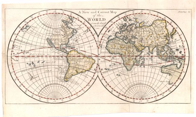
Subject: World

Period: 1730 (circa)

Publication:

Color: Hand Color

Size:
11.5 x 6 inches
29.2 x 15.2 cm
Download High Resolution Image
(or just click on image to launch the Zoom viewer)

This small English-produced world map was likely published by Patrick Gordon in The Geographical Grammar. Gordon's maps were reportedly engraved by John Senex. The double hemispheric map depicts a period of extensive exploration and geographical discoveries. Australia (New Holland) is vaguely formed with some coastal areas undefined. The continent is still connected to New Guinea that also has blank, undefined coastal areas. New Zealand (V. Leeland) is depicted with only an indistinct coastline. The mysterious coastline of Davis's Land also appears in the eastern South Pacific. California is shown as an island and a large Anian Strait indicates the possibility of a Northwest Passage. In the North Pacific Ocean the faint outline of Compagnes Land stretches between Asia and North America.

References:

Condition: B+

Issued folding, now flattened with a few repairs in the margin on verso.

Estimate: $220 - $275

Sold for: $275

Closed on 6/1/2011

Archived