Catalog Archive
Auction 136, Lot 300

"Portland Harbor Maine", U.S. Coast Survey

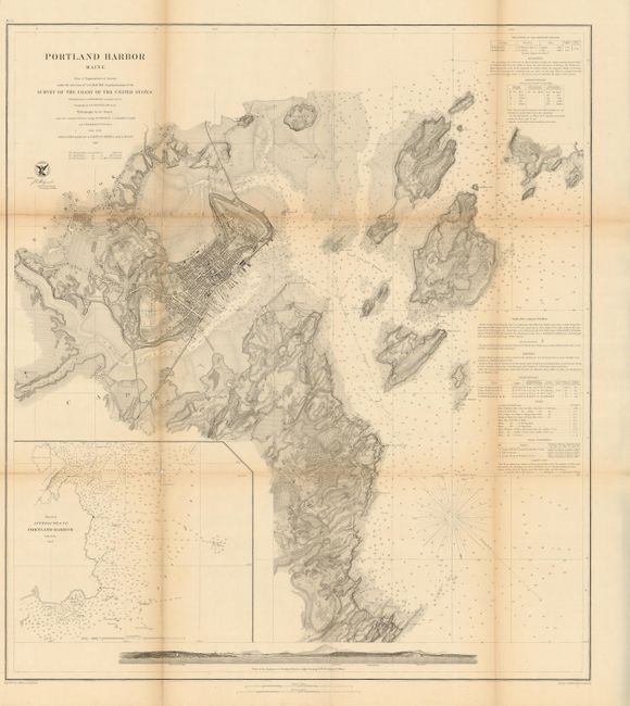
Subject: Portland, Maine

Period: 1862 (dated)

Publication:

Color: Black & White

Size:
25.3 x 28.5 inches
64.3 x 72.4 cm
Download High Resolution Image
(or just click on image to launch the Zoom viewer)

The Office of Coast Survey is the oldest U.S. scientific organization, dating from 1807 when Congress directed that a "survey of the coast" be carried out. By 1836, it was called the U.S. Coast Survey and in 1878, the name was changed to the U.S. Coast and Geodetic Survey. Today the Office of Coast Survey is a division of the National Oceanic and Atmospheric Administration NOAA.

The survey teams, composed of civilians as well as Army and Naval officers, charted the nation's waterways and produced a wide array of reports, survey charts, hydrographic studies of tides and currents, astronomical studies and observations, and coastal pilots. These charts are an important record of the changing nature of the nation's coastlines. In additional to coastal charts, the U.S. Coast and Geodetic Survey produced land sketches, Civil War battle maps, and the early aeronautical charts.

A fine chart of Portland's harbor and its approaches, extending to Long Island. The interior is nicely developed to show terrain features including a street grid for Portland. Sailing directions provide guidance for mariners plus a listing of the locations of four lighthouses. The sea view profile at the bottom is from a distance of three miles. It clearly shows the town, plus locates the Portland Head lighthouse, Observatory, Bangs' Island, and White Head.

References:

Condition: B

Folding as issued with a separation in fold below title and some minor toning.

Estimate: $150 - $200

Sold for: $75

Closed on 6/1/2011

Archived