Catalog Archive
Auction 136, Lot 278

"Yosemite National Park Showing Boundaries Established by Act of Congress approved Feb. 7,1905 and Lands Eliminated therefrom and placed in the Sierra Forest Reservation", General Land Office

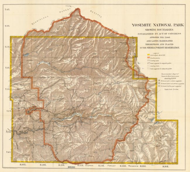
Subject: Yosemite, California

Period: 1906 (circa)

Publication:

Color: Printed Color

Size:
26.8 x 24.3 inches
68.1 x 61.7 cm
Download High Resolution Image
(or just click on image to launch the Zoom viewer)

This colorful map illustrates a significant expansion of Yosemite National Park with the incorporation of the Yosemite Grant into borders. This is the early issue without the Big Tree Grant (Mariposa Grove) that was added in the House version of this map. It contains considerable detail on a scale of 2 miles to the inch. A legend provides an explanation of the color code, which shows the limits of the park as established in 1890 by Congress, the newly (Feb. 7, 1905) recommended Park boundary, along with existing and suggested trails and roads. Also depicts the patrol stations and sub-stations, and a permanent military post as recommended by the Yosemite Park Commission the previous year.

References:

Condition: A+

Folding as issued.

Estimate: $180 - $230

Sold for: $160

Closed on 6/1/2011

Archived