Catalog Archive
Auction 136, Lot 269

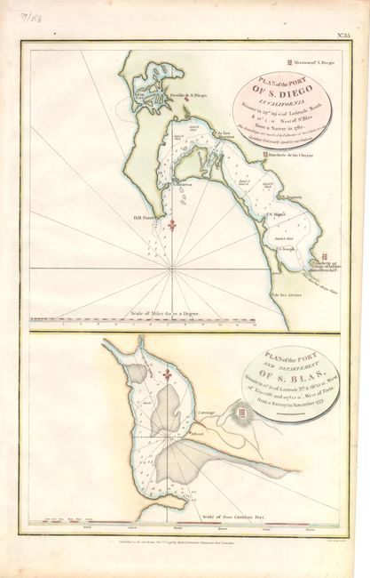
"Plan of the Port of S. Diego in California…1782 [on sheet with] Plan of the Port and Department of S. Blas… 1777", La Perouse, Comte Jean F. Galoup, de

Subject: San Diego, California

Period: 1798 (dated)

Publication: Voyage Round the World…

Color: Hand Color

Size:
9.5 x 14.2 inches
24.1 x 36.1 cm
Download High Resolution Image
(or just click on image to launch the Zoom viewer)

A pair of scarce and important early charts of San Diego and San Blas that are printed on one sheet with common border. The maps were based on the surveys of Juan Pantoja. Sailing out of San Blas, Pantoja, a captain of the Manila trade for Spain, visited much of today's California coast where he surveyed each harbor. He shared these surveys with La Perouse, who probably never actually entered the San Diego harbor, relying instead on Pantoja's chart. The map names the Presidio de St. Diego as well as several ranches and missions. This is one of the earliest printed maps of San Diego, predated only by Dalrymple's map and a few other unobtainable charts. San Blas was the primary Spanish port on the west coast of Mexico. This is from the English edition, published by G.G. & J. Robinson.

References:

Condition: A+

Estimate: $300 - $400

Sold for: $350

Closed on 6/1/2011

Archived