Catalog Archive
Auction 136, Lot 264

"Post route map of the United States Arizona showing post offices with the Intermediate Distances on Mail Routes …", U.S. Government
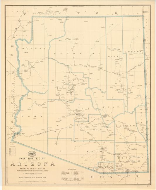
Subject: Arizona

Period: 1925 (dated)

Publication: Post Office Department

Color: Printed Color

Size:
30.5 x 38 inches
77.5 x 96.5 cm
Download High Resolution Image
(or just click on image to launch the Zoom viewer)

This uncommon, large scale map shows in great detail the mail routes and railroads of the state. The mail routes name many very small settlements not normally seen on maps of the state. Each route originates from a railhead and some of the routes originate in neighboring states. Above the title is the shield of the Post Office with mounted rider and locomotive in the background.

References:

Condition: A+

Very nice example rolled and never folded. Seller's stamp in lower margin "Edward Denny & Co., The Map House, San Francisco."

Estimate: $130 - $160

Sold for: $100

Closed on 6/1/2011

Archived