Catalog Archive
Auction 136, Lot 263

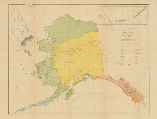
"Map of Alaska and Adjoining Regions. Compiled by Ivan Petroff Special Agent Tenth Census", U.S. Government

Subject: Alaska

Period: 1880 (dated)

Publication:

Color: Printed Color

Size:
30.5 x 23.8 inches
77.5 x 60.5 cm
Download High Resolution Image
(or just click on image to launch the Zoom viewer)

Published by the Dept. of Interior for the Tenth Census this fine and detailed map of Alaska is the result of the extensive travels of Ivan Petrof. It is from Petrof's Report on the Population, Industries, and Resources of Alaska, published in 1884. The map provides and excellent view of the native villages and small settlements clustered on the Kenai Peninsula and along the coast. It contains an inset detailing the Bering Sea and Aleutian Islands. The map features dramatic and quite early topography with notations crediting Russian, French and English charts.

References:

Condition: A+

Estimate: $150 - $200

Sold for: $110

Closed on 6/1/2011

Archived