Catalog Archive
Auction 136, Lot 227

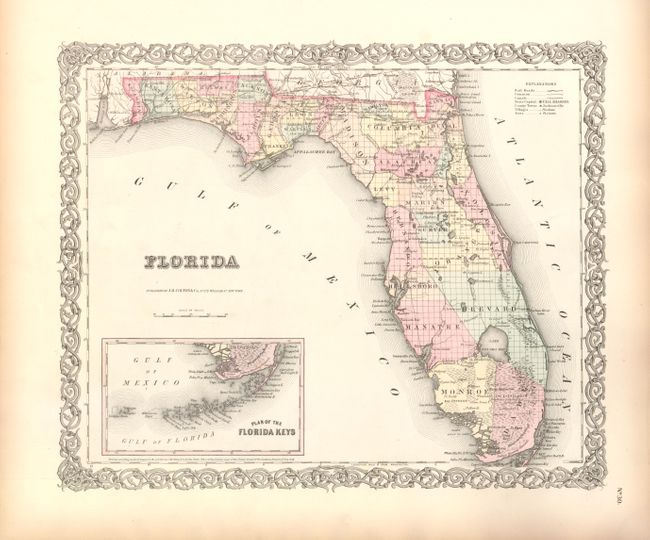
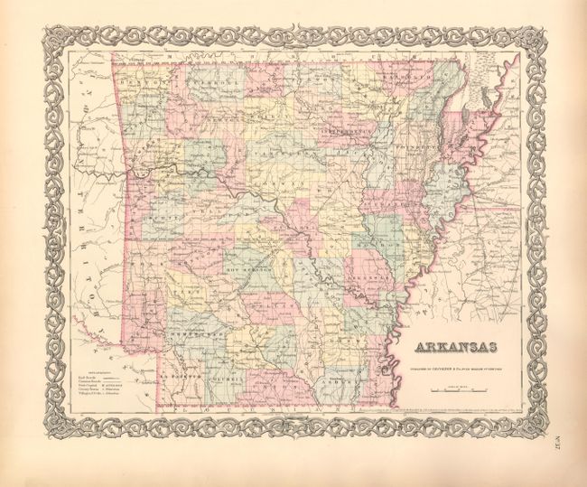
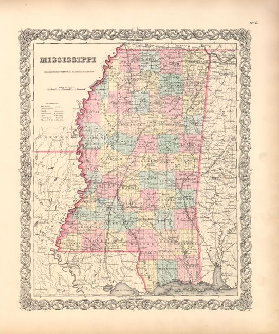
"[Lot of 3] Florida [and] Arkansas [and] Mississippi", Colton, Joseph Hutchins

Subject: Southern United States

Period: 1855 (dated)

Publication: Atlas of the World

Color: Hand Color

Size:
15 x 12.5 inches
38.1 x 31.8 cm
Download High Resolution Image
(or just click on image to launch the Zoom viewer)

This matched set of maps all have the decorative scroll-style border. The lot includes:

: 1) This detailed map of Florida shows the state with only thirty-one established counties. The south is dominated by Monroe, Dade, Manatee, Brevard and Hillsboro counties. The map does not include Liberty County, which was formed from part of Gadsden in 1855. Madison is in its large configuration with Layfette and Taylor to be carved out in 1856. There is a good network of early roads in the panhandle, but no railroad are indicated even though the legend shows them. A railroad is named just north in Georgia. Tallahassee is shown as the state capital. There is good detail of wagon roads, forts and villages, rivers and swamps. An inset, Plan of the Florida Keys, continues to show the Keys to Tortugas Islands. Good detail throughout including interesting place names like the Indian area of Bowlegs Land.

2) Similar content and details to the Florida map above. The counties individually hand colored and are up-to-date to 1852 as no major county changes were made between then 1859. A few railroads radiating from Little Rock are named, but are not shown according to the legend, including: the Ft. Smith Railroad, Arkansas Midland R.R., and the Cairo & Fulton R.R. The map shows a surprisingly dense network of wagon roads connecting even the smallest settlement.

3) Similar in content and details to the maps above. The counties shown appear to be up-to-date state with more than 55 named and indicated in full color. A few railroads radiate from Jackson: the New Orleans, Jackson & Great Northern heads south, the east-west line runs to Vicksburg and east only to Brandon. The Memphis & Charleston Railroad cuts across the northeast corner of the state. Filled with a dense network of wagon roads. Includes the separate atlas page describing Mississippi.

References:

Condition: A+

All are near fine with strong impression and bright original color on full sheets with wide margins. A little edge toning, still fine.

Estimate: $275 - $325

Sold for: $200

Closed on 6/1/2011

Archived