Catalog Archive
Auction 136, Lot 172

"A New and Accurate Map of the United States of America, &c. from the best Authorities", Brown, Thomas

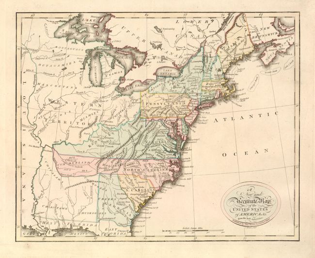
Subject: Eastern United States

Period: 1809 (circa)

Publication: General Atlas

Color: Hand Color

Size:
13.3 x 10.8 inches
33.8 x 27.4 cm
Download High Resolution Image
(or just click on image to launch the Zoom viewer)

A very scarce little map from the first general atlas published in Scotland. The map covers the region from the eastern seaboard to the Mississippi River. Western Territory takes in all the area west of the Ohio River with several Indian tribes located within it. Kentucky occupies a loosely organized region west of Virginia. In present-day Tennessee, the North Carolina land grants of Cumberland and Holstonare located, extending North Carolina in an odd configuration. An unnamed territory in the region of Mississippi and Alabama is the tribal territory of the Chickasaws, Cherokees, Choctaws and Muskogees. Main is noted as belonging to Massachusetts Bay.

References:

Condition: A

Very fine example with strong impression and good color, and full margins. On thick watermarked paper (C & S 1809).

Estimate: $400 - $600

Sold for: $375

Closed on 6/1/2011

Archived