Catalog Archive
Auction 136, Lot 157

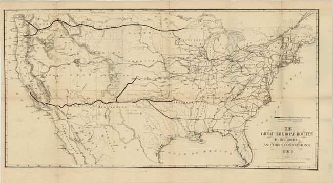
"The Great Railroad Routes to the Pacific, and Their Connections", Gorlinski, Joseph

Subject: United States

Period: 1869 (dated)

Publication: Rep. Com. No. 219, 40th Cong., 3d Sess.

Color: Black & White

Size:
27.5 x 14 inches
69.9 x 35.6 cm
Download High Resolution Image
(or just click on image to launch the Zoom viewer)

A terrific railroad map that is most notable in its depiction of the Golden Spike area in Utah: the entire track is shown completed except for 50 miles between Weber Canyon and Fort Bridger! As far as we know this is the only railroad map with this unique depiction. It was published just days before the completion if this historic railway. Scores of railroads are located throughout the country, including complete and projected lines; the Northern & Southern Pacific Trunk lines are shown in bold lines. Published by the American Photo-Lithographic Company using a printing technique called "Osborne's Process."

References:

Condition: B+

Dark impression on thick paper with full margins. Folding as issued with some weakness along one fold with archival tape for support on verso.

Estimate: $250 - $325

Sold for: $375

Closed on 6/1/2011

Archived