Catalog Archive
Auction 136, Lot 153

"Map of the United States", Case, Tiffany & Company

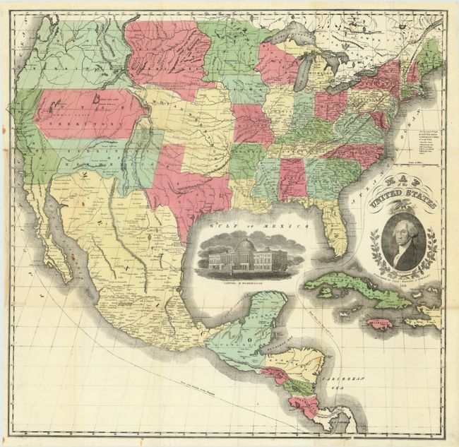
Subject: United States

Period: 1851 (dated)

Publication:

Color: Hand Color

Size:
23.5 x 24 inches
59.7 x 61 cm
Download High Resolution Image
(or just click on image to launch the Zoom viewer)

A scarce large format map of the United States with striking insets of a President Washington and a view of the Capitol of Washington. The projection oddly distorts and for-shortens the western portion of the U.S. The very interesting territorial configurations include the pre-Gadsden Purchase border with Mexico, a large Oregon Territory occupying the entire Northwest and extending to the Continental Divide. Bordering Oregon is a huge Missouri Territory that extends east to an oversized Minnesota Territory at the Missouri River. The very large Indian Territory sits between Utah, Missouri, and Missouri Territory. Utah and New Mexico are at their largest extent. In Utah is the Mormon Settlement at the Great Salt Lake. The map extends to include most of Central America and the western part of the West Indies. Lacks covers.

References:

Condition: A

A fine example with bright, full original coloring on thin banknote style paper. Folding as issued. One fold intersection split and a couple tiny spots, still very good. The finest example of this map we have seen.

Estimate: $700 - $900

Sold for: $650

Closed on 6/1/2011

Archived