Catalog Archive
Auction 136, Lot 149

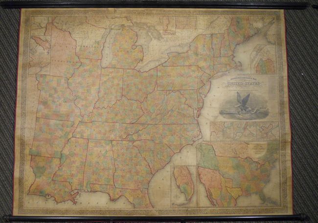
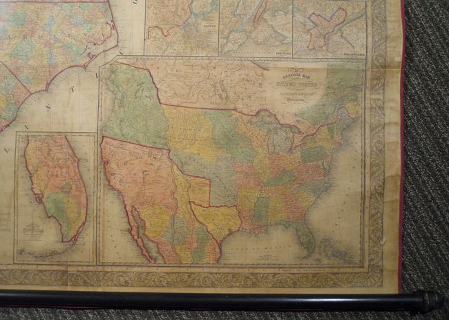
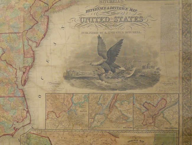
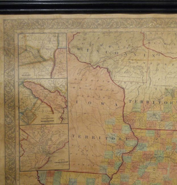
Exceptional Wall Map Featuring the Independent Republic of Texas - 1844

"Mitchell's Reference & Distance Map of the United States", Mitchell, Samuel Augustus

Subject: United States, Republic of Texas

Period: 1844 (dated)

Publication:

Color: Hand Color

Size:
67 x 52.5 inches
170.2 x 133.4 cm
Download High Resolution Image
(or just click on image to launch the Zoom viewer)

This stunning wall map portrays the nation at the end of the Jacksonian era and at the beginning of the movement that would become known as Manifest Destiny. Rapid settlement is evident in the county development, which is delineated in color on this edition. The emerging railroad system is shown along with the highly developed canal network. Beneath the title is a large engraved composite view designed by W. Mason that includes the capitol building in Washington, D.C. and a large American eagle perched on a seashell boat. This theme is echoed in the surrounding decorative border with seashells in each corner and at the bottom. The map was compiled and engraved by James H. Young with the assistance of F. Dankworth, E. Yeager and E.F. Woodward.

Illustrating an era of rapidly expanding westward settlement, the large map covers the United States westward to include all of Missouri, Arkansas and Louisiana with a portion of Iowa Territory. It is highly detailed showing counties, townships, parishes, towns and settlements, trails and wagon routes, canals, and railroads. Eleven inset maps and city plans provide additional information. The largest inset (17" x 21"), General Map of the United States with the contiguous British & Mexican Possessions, includes information for the Great Basin from John Arrowsmith's important map. It features the Independent Republic of Texas in its small configuration with the early settlements of Houston, San Felipe de Austin and San Antonio. It shows the huge Oregon Territory extending far to the north into present-day British Columbia, illustrating the growing tensions between the United States and Britain in the Oregon boundary dispute. It also delineates the large Iowa, Missouri and Indian territories and traces nascent wagon roads and trails. The other insets are: Vicinity of Boston; Vicinity of New York; North part of Maine; Vicinity of Philadelphia; the South Part of Florida; Vicinity of Rochester; Vicinity of the Falls of the Niagara; Vicinity of Albany; Vicinity of Baltimore and Washington; and the Vicinity of Charleston.

This is an exceptional example of Mitchell's rarely offered wall map, which was first issued in 1834 without Mitchell's name in the title. The edition of 1841 eliminated insets of Cincinnati and New Orleans to provide a better depiction of expanding settlement in Iowa Territory including the first counties along the eastern boundary. This edition retains this configuration but shows slightly more county development in Michigan, Wisconsin and Iowa. This edition has the 1833 copyright date along with Mitchell's imprint dated 1844. This is the best example we've seen from this series of large Mitchell/Young wall maps and we can only find one other record of this edition being on the market in the past 25 years.

This map was previously owned by Oliver Ames, Jr. who was President of the Union Pacific Railroad when the first transcontinental railroad was completed. He also owned Oliver Ames & Sons, the largest manufacturer of shovels in the world. The Ames family became one of the wealthiest in America.

References: Ristow p. 309-310.

Condition: A

Beautifully and professionally conserved and rebacked with modern linen with new red cloth selvage protecting the edges. There is some expert paper restoration in the margins. Complete with detached rollers.

Estimate: $8,000 - $10,000

Unsold

Closed on 6/1/2011

Archived