Catalog Archive
Auction 136, Lot 135

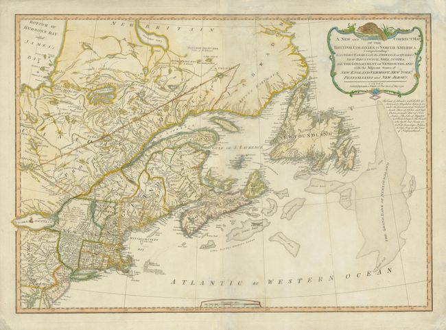
"A New and Correct Map of the British Colonies in North America Comprehending Eastern Canada with the Province of Quebec, New Brunswick, Nova Scotia, and the Government of Newfoundland: with the Adjacent States of New England, Vermont, New York…", Laurie & Whittle
Subject: Canada & United States

Period: 1794 (dated)

Publication: A New and Elegant Imperial Sheet Atlas

Color: Hand Color

Size:
26.4 x 18.6 inches
67.1 x 47.2 cm
Download High Resolution Image
(or just click on image to launch the Zoom viewer)

This detailed map includes eastern Canada with Quebec, New Brunswick, Nova Scotia, and Newfoundland together with New England, New York, New Jersey and parts of Pennsylvania, Maryland and Delaware. The great fishing banks are graphically depicted. There are numerous interesting notations throughout, e.g., "This vast Tract of Land, which is the Antient Couchsachrage one of the Four Beaver-Hunting Countries of the Six Nations, is not yet Surveyed" and "Col. Arnold's Rout [sic] in 1775" referring to Benedict Arnold's winter campaign at the start of the American Revolution. The title cartouche is surmounted by a beaver.

References: Stevens & Tree #65-c.

Condition: B

Some repairs on the fold and damp stains in the image. There is also soiling on the right portion on the verso.

Estimate: $600 - $750

Sold for: $450

Closed on 6/1/2011

Archived