Catalog Archive
Auction 135, Lot 692

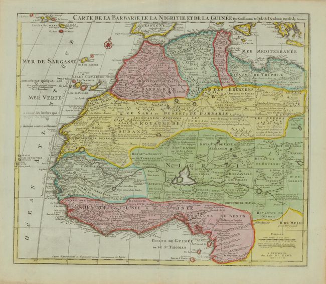
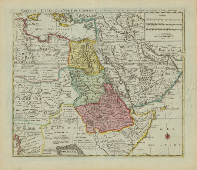
"[Lot of 2] Carte de la Barbarie le la Nigritie et de la Guinee [and] Carte de l'Egypte de la Nubie de l'Abissinie &c.", Delisle/Elwe

Subject: Northern Africa

Period: 1792 (dated)

Publication:

Color: Hand Color

Size:
22.2 x 19.2 inches
56.4 x 48.8 cm
Download High Resolution Image
(or just click on image to launch the Zoom viewer)

The northern part of Africa is covered by these fine maps. They first appeared in Delisle's Atlas de Geographie (1700-1712) and were here re-issued by Jan Elwe with his imprint in 1792. Carte de la Barbarie le la Nigritie et de la Guinee covers northwestern Africa from Barbary, Nigeria and Guinea to below the equator. There is a mass of geographic detail and notations in the interior with information on the rivers and lakes. Numerous tent encampments are depicted throughout the Sahara Desert. Carte de l'Egypte de la Nubie de l'Abissinie &c. covers northeastern Africa, the Red Sea and the Arabian peninsula. It shows the political divisions and kingdoms, roads, topography, settlements, encampments and much more. The Nile originates in the mountains near the L. de Dambee. The map is filled with notations concerning the various tribes, trade routes, etc. - one indication where many emeralds can be found.

References:

Condition: B+

There is some printer's ink residue on the 2nd map, else very good with some minor edge tears well away from the maps.

Estimate: $300 - $400

Sold for: $220

Closed on 2/16/2011

Archived